Road conditions quickly deteriorate as heaviest of snowfall begins in Kansas City
READ MORE
Winter storm hits Kansas City
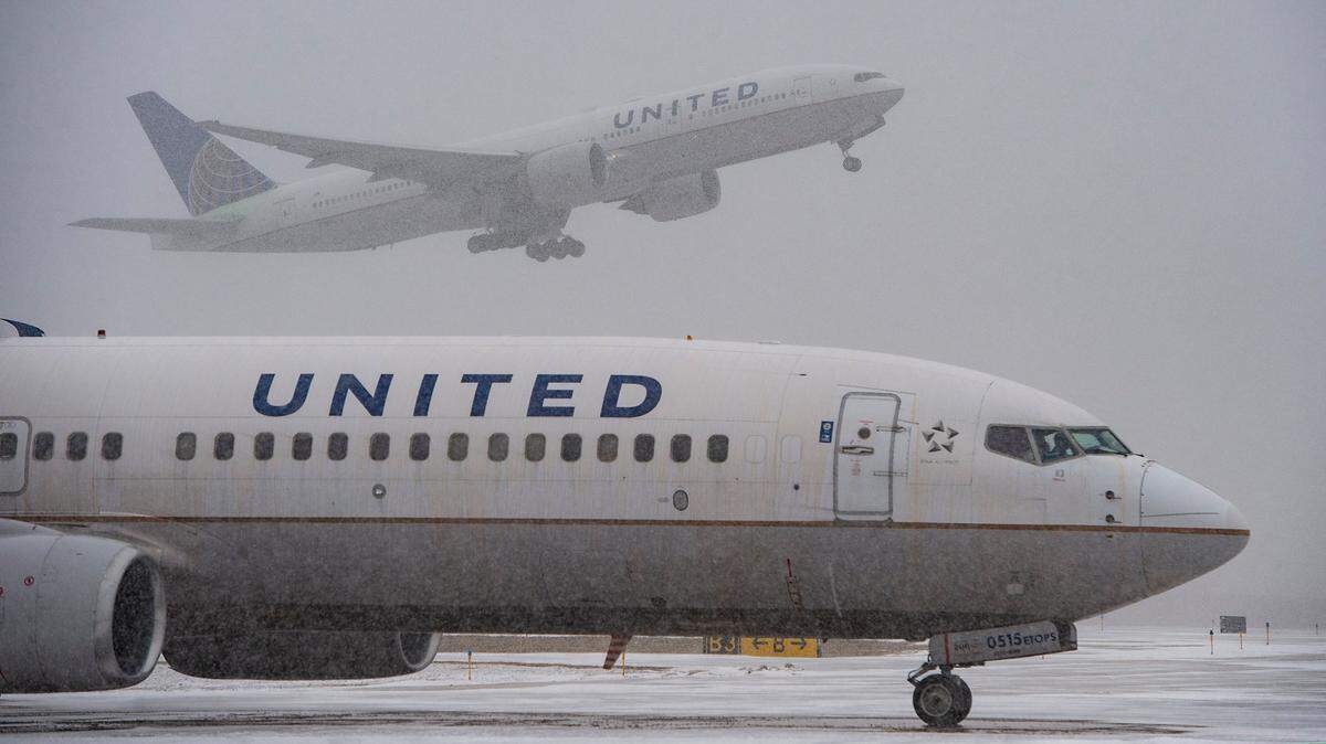
Another round of winter weather has arrived in Kansas City, bringing with it ice, snow and wind gusts up to 35 mph. The storm has caused slick roads as well as school and office closures.
Expand All
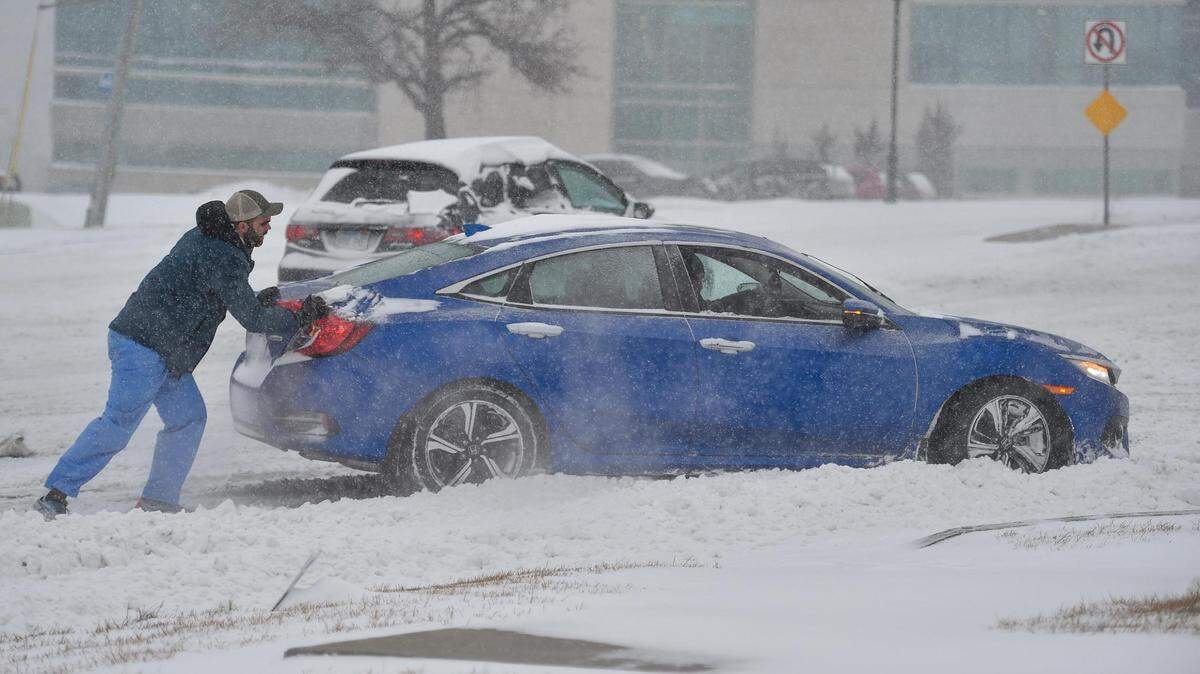
Driving conditions rapidly deteriorated early in Thursday’s morning commute in Kansas City as freezing rain and sleet switched over to heavy snow that blanketed area streets and highways.
The intense snow started falling shortly before 5 a.m. and was expected to continue to for several hours. Heavy snowfall was expected through noon, according to the National Weather Service in Kansas City.
Snow is expected to fall at rates as high as 1 to 1.5 inches per hour during this period.
Early in the transition from freezing rain to snow, rare thundersnow was reported at the Wheeler Downtown Airport, the weather service said on Twitter around 5 a.m.

Sustained winds of 20 to 25 mph with gusts up to 35 mph were likely to create blowing and drifting snow. This will lead to reduced visibility and extremely hazardous travel conditions roughly between 6 a.m. and 3 p.m.

Early in the storm, the conditions proved challenging for drivers.
“The number of slide-offs is starting to mount up,” the Missouri Department of Transportation’s Kansas City District said on social media “Plz slow down and take it easy. Drive according to the conditions. Be Safe. Be Smart.”
A two-car crash along northbound Interstate 49 near the Three Trails Crossings in southern Kansas City had closed two lanes of the highway. Another crash was reported along southbound Interstate 29 at U.S. 169 highway in Kansas City’s Northland.
Drivers were also having difficulties along westbound Interstate 70 near Troost Avenue in Kansas City. Emergency response crews gave motorists “a little push to get them going,” MoDOT Kansas City said on Twitter.
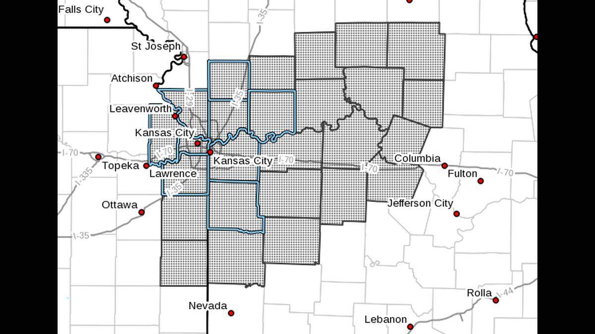
A band of heavy snow was expected to set up along the south side of the Kansas City metro area stretching eastward along Interstate 70 through Columbia, Missouri. A narrow strip of 6 to 8 inches of snow was expected in this area.
Meanwhile areas to the immediate north and south of that band should expect to see slightly less accumulations. Between 3 and 6 inches of snow is expected in the northern half of Kansas City.
The snow is expected to begin to wind down Thursday afternoon in Kansas City and move into eastern Missouri by the evening.
This story was originally published February 17, 2022 at 7:01 AM.