
Storms soak Kansas City area; when more severe weather and heavy rain may return
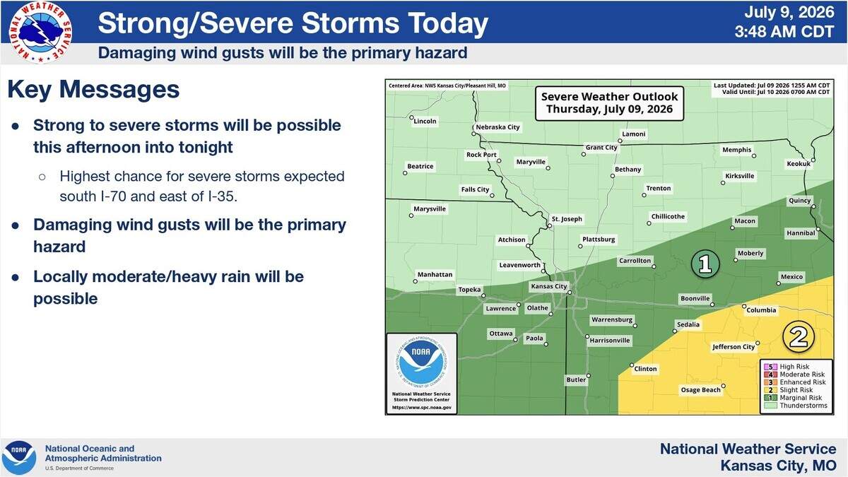
After storms soaked parts of the Kansas City area with 1 to 3 inches of rain, more thunderstorms, including a few that could be severe, may redevelop later Thursday, bringing the risk of damaging winds, hail and another round of heavy downpours, according to the National Weather Service.
Before the next round, the metro should get a break — and that clearing could help make Thursday one of the hottest days of the week.
Temperatures are expected to climb to around 88 degrees, which is normal for this time of year. Heat index values over 100 degrees are possible along and south of Interstate 70.
More storms may develop in the afternoon east of Interstate 35, with the threat of severe weather being conditional, the weather service said. What happens with the morning storms will influence the setup of severe storms.
If clouds and rain linger, the air may not heat up enough for storms to grow strong. Morning storms could also shove around boundaries in the air that help determine where new storms form later, according to the weather service.
If severe weather develops, damaging wind gusts will be the primary hazard. There will also be a chance for heavy rain.
Areas south of Interstate 70 and east of I-35 have the highest risk of several storms. The Storm Prediction Center has placed that area under a slight risk (Level 2 of 5). Meanwhile, the Kansas City area is under a marginal risk (Level 1 of 5).

A stalled front will stick around Friday through Sunday, bringing the chance of daily on-and-off scattered storms and muggy air, according to the weather service. A few strong to severe storms will be possible Friday, with the highest chance south of Interstate 70. Moderate to heavy rain will again be possible.
Temperatures are expected to be in the upper 80s and low 90s on Friday, Saturday and Sunday.
Next week, storm chances drop, allowing the metro to dry out. It will gradually get hotter each day, with temperatures expected to reach the low to mid-90s. With dew point values remaining in the mid-60s, heat index values will remain below 100 degrees.
