Stormy, muggy week: Three windows for severe storms target Kansas City this week
The Kansas City area is in for a muggy, storm-prone week, with multiple chances for strong to severe thunderstorms before cooler, drier air arrives this weekend.
Before any stronger storms arrive, the metro will get a warm, windy Monday, with highs around 80 and south to southwest winds gusting 25 to 35 mph, according to the National Weather Service.
A few light showers are possible, but most places should stay dry because a layer of warm air aloft should keep storms from building, the weather service said.
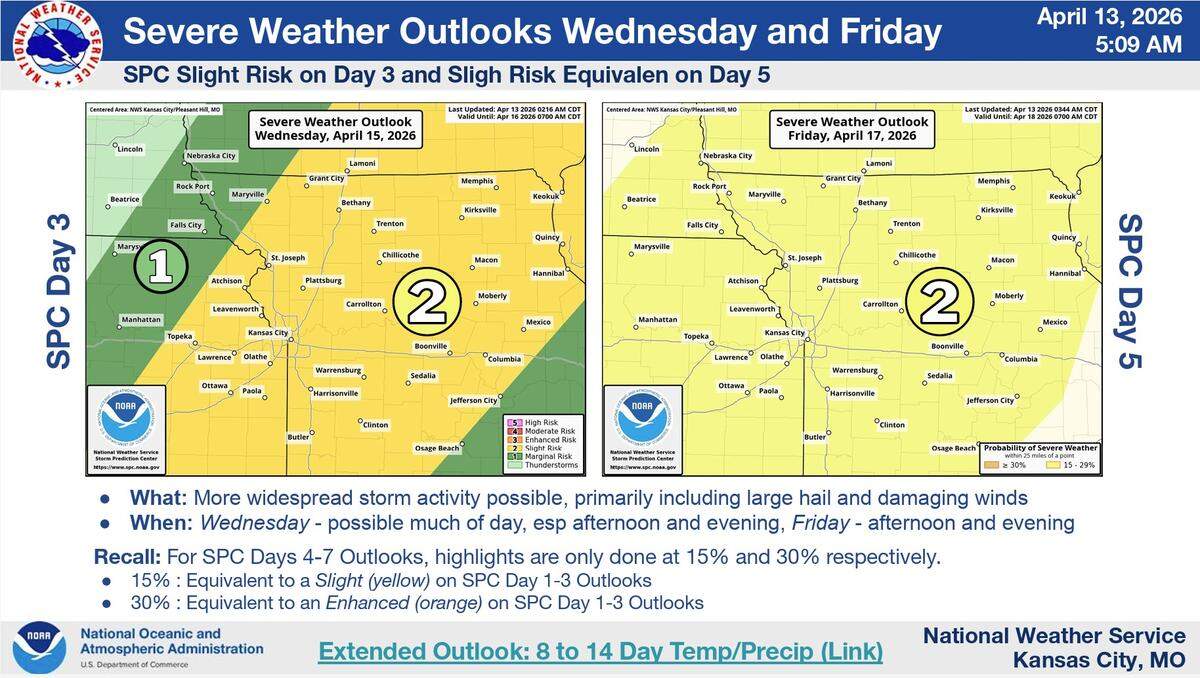
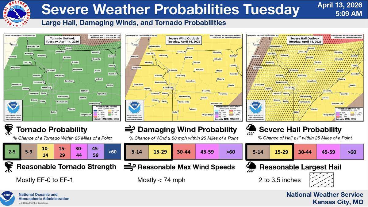
On Tuesday, the metro area faces its first and best chance for severe storms, with more chances on Wednesday and Friday.
Strong storms may initiate in southern Kansas and northern Oklahoma on Tuesday and move toward the metro in the evening and overnight, according to the weather service. Large hail and damaging winds are the main threats, with a tornado possible.
The National Weather Service’s Storm Prediction Center has placed most of the Kansas City region under a slight risk for severe storms, Level 2 of 5.
More widespread storms are possible on Wednesday, especially in the afternoon and evening, but the severe weather potential hinges on how much the atmosphere can recharge after overnight storms and cloud cover.
After a lull on Thursday, storms are possible again Friday afternoon and evening.
The Storm Prediction Center has placed most of the region under a slight risk for severe storms on Wednesday, Level 2 of 5. For Friday, the center’s Day 5 outlook shows a 15% chance of severe storms.
Temperatures this week will be in the upper 70s to 80s through Friday, well above the average of 65 degrees that is typical for this time of year.
Drier, but cooler weather is expected for the weekend, with temperatures in the low to mid-60s.