Downpours dumped 2+ inches of rain around KC. See totals — plus weekend forecast
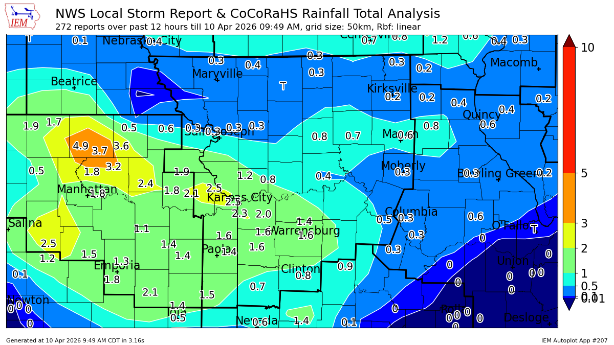
Showers and thunderstorms rolled through the Kansas City area overnight, bringing heavy downpours that dumped around 2.5 inches of rain in parts of the metro, according to rain gauge reports compiled by StormWatch.com and the Iowa Environmental Mesonet.
More than two inches appears to have fallen in a swath from Leavenworth County into Johnson County and then east into Jackson County, based on rainfall data reported to the National Weather Service.
The Lansing area reported 2.52 inches of rain, the highest 24-hour total ending at 9 a.m. Friday, according to data from the Iowa Environmental Mesonet.
That was closely followed by 2.46 inches in Kansas City, Kansas, 2.37 inches in Overland Park and the Brookside area of Kansas City and 2.27 inches in Mission Hills, according to Iowa Environmental Mesonet reports.
Meanwhile, rain gauges showed that 2.44 inches of rain fell in Shawnee and Merriam, according to StormWatch.com, which collects data from rain gauges across the metro.
Other areas with more than two inches of rainfall include 2.32 inches in Prairie Village and 2.28 inches in Fairway, according to StormWatch.com.
At Kansas City International Airport (MCI), 1.89 inches of rain fell in the 24 hours ending at 9 a.m. Friday. Meanwhile, 1.34 inches fell at the Kansas City Downtown Airport—Wheeler Field, according to observed rainfall totals.
Meanwhile, 1.89 inches of rain fell at Kansas City/Lee’s Summit Regional Airport, 1.2 inches in Sedalia, 1.35 inches in Olathe, and 1.41 inches at Johnson County Executive Airport in Olathe.
The storms kicked off what will be a wet weekend in Kansas City as rounds of showers and thunderstorms will bring repeated rain chances through Sunday and into next week, according to the National Weather Service.
Although the rain ended Friday morning in the metro, another batch of showers and thunderstorms will move back into the area late Friday and continue into Saturday morning.
The threat of strong to severe storms is low through the weekend, the weather service said.