
Kansas City faces several days of storms. Will any turn severe?
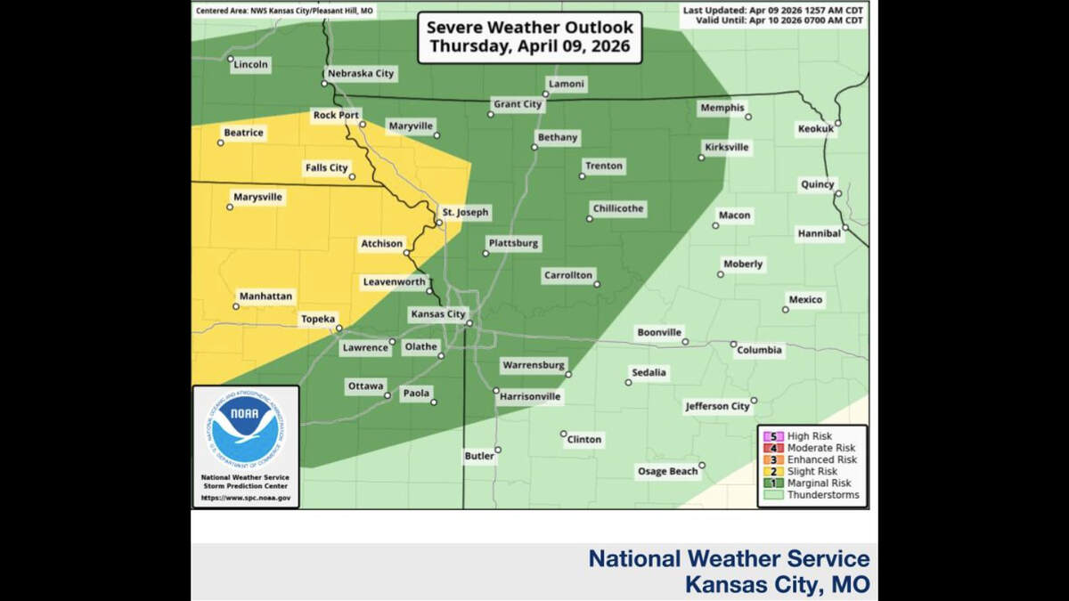
A stretch of stormy spring weather returns to the Kansas City area Thursday, with on-and-off showers and thunderstorms likely through the weekend. Some storms could turn severe Thursday night, the National Weather Service said.
Spotty showers are possible Thursday, mainly in northern Missouri, but many places will remain dry, the weather service said. Temperatures will climb into the 70s to near 80 degrees.
The metro should top out near 77 degrees, well above the average of 64 degrees for this time of year.

“Storm chances will increase (Thursday night) with the chance for some of those storms to be severe,” the agency said. “The main threat with these storms will be for large hail; however, damaging winds may also be possible.”
Severe storms are most likely between 8 p.m. Thursday and 2 a.m. Friday, the weather service said. The best chance will be north of Interstate 70 and west of Interstate 35.
Several rounds of showers and thunderstorms are expected Friday through the weekend. The threat of severe weather is low, but minor flooding is possible after several days of rain.
Temperatures will return to normal on Friday, expected to top out at around 61 degrees. Warmer weather is expected over the weekend, with temperatures climbing to around 77 degrees on Saturday and about 74 degrees on Sunday.
“The next threat for severe storms will come Monday night into Tuesday, but uncertainty remains high,” the weather service said.
