See how Kansas City voter districts are divided in Missouri’s 2025 gerrymandered map
The Missouri Supreme Court on Tuesday upheld the state’s gerrymandered congressional map, handing Republicans and the Trump administration a major win in their months-long push to oust Kansas City’s Democratic congressman, U.S. Rep. Emanuel Cleaver.

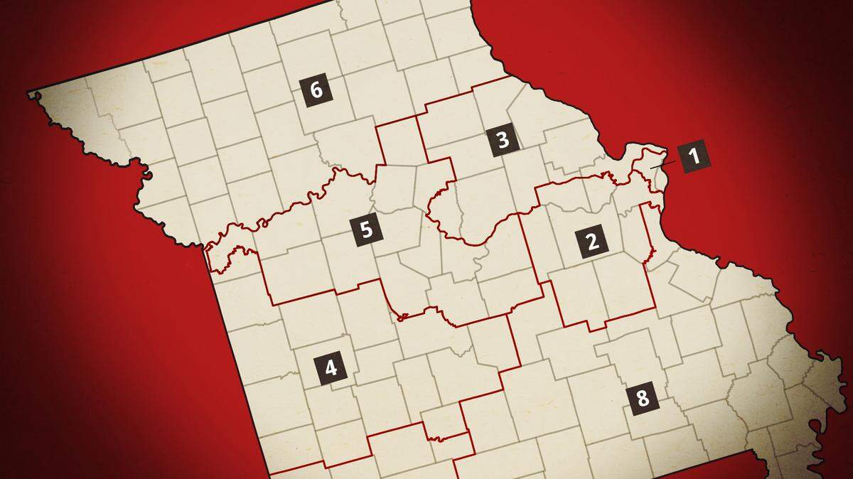
Under the 2025 gerrymandered map, Kansas City voters would be split into the 4th, 5th and 6th Congressional Districts. Cleaver’s 5th District would extend hundreds of miles east to central Missouri, while the 4th District would stretch from downtown Kansas City to the Ozarks region. It would carve up the Kansas City area into three Republican-leaning congressional districts as President Donald Trump pressures states to gerrymander their maps to ensure Republican control of Congress.
The voters in the Kansas City area’s Northland, including Clay and Platte counties, would be included in Republican U.S. Rep. Sam Graves’ 6th District that stretches across northern Missouri to the Illinois border. Graves earlier this year announced his plan to retire at the end of his term, sparking a heated Republican primary to succeed him.
The map would use Troost Avenue, a historic symbol of racial segregation in Kansas City, as the dividing line between the 4th and 5th Districts.
A closer look at the map shows several voter districts in Jackson County split between Missouri’s 4th and 5th Congressional districts.
It would place residents living on the west side of Troost in the 4th Congressional District that would stretch to southern Missouri. The district is currently represented by Republican U.S. Rep. Mark Alford, a former TV anchor.
Residents on the east side would live in a 5th District, currently represented by Cleaver, that extends to the central part of the state.
This story was originally published May 13, 2026 at 4:40 PM.