Explore maps of downtown Royals stadium: See size, entertainment district & more
Visions of a new Kansas City Royals stadium at Washington Square Park are coming into sharper focus — even as major questions about funding and design remain unresolved.
A Kansas City Council vote has authorized negotiations for up to $600 million in city support. But it is unclear what support the project can expect from the team or other public sources, and no official renderings have released.
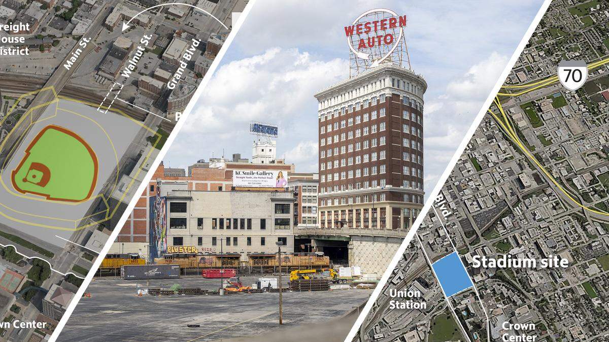
In the absence of firm details, a series of maps sketches what the ballpark could look like — from its footprint at Washington Square Park to how it might be oriented relative to the sun and skyline views.
These maps also explore where key elements could fall, including home plate, the outfield and a potential entertainment district modeled after developments like Wrigleyville in Chicago.
They also highlight how fans might move to and from the stadium, tracing connections to nearby highways and surrounding streets — offering an early, if still hypothetical, look at how a downtown ballpark could reshape this corner of Kansas City.
Kauffman Stadium vs. Washington Square Park
Where could an entertainment district go?
A potential area for an entertainment district could be west of Walnut Street, with a pedestrian bridge linking Walnut Street to the stadium. Crown Center could play a role in a future entertainment district.
Getting to the stadium
How fans get to and from the stadium is another key question. The site would be accessible via U.S. 71, Interstate 35 and Interstate 70, along with streetcar service along Main Street.
Position of the stadium
Stadium orientation is another unknown. While MLB guidelines call for home plate to face east to northeast, the final alignment would depend on the site — including how it integrates with the planned green space.
The Star’s Eric Adler and Kacen Bayless contributed.