
Spotty heavy rain possible Friday; hotter, stickier weekend ahead in KC
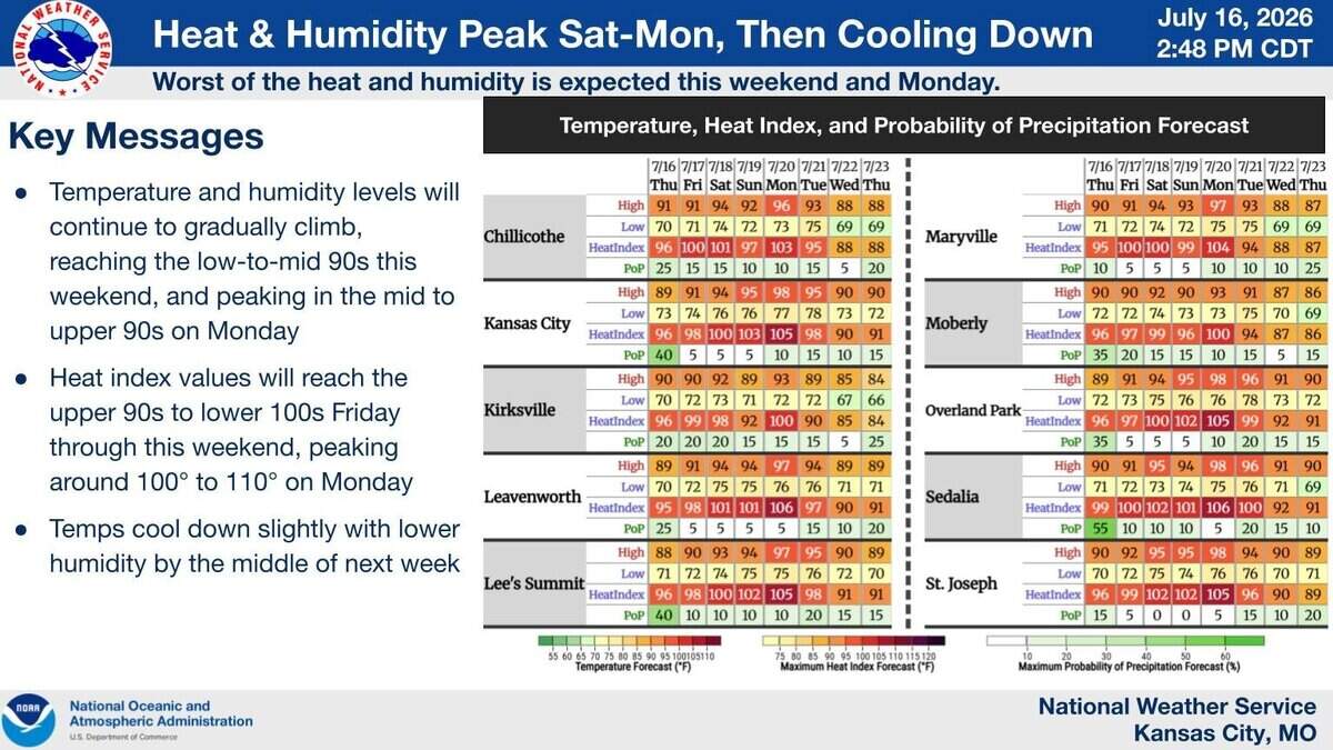
Spotty storms could dump heavy rain on parts of the Kansas City area Friday afternoon as heat and humidity ramp up for the weekend, the National Weather Service said.
Sunny skies will help temperatures climb to around 91 degrees Friday, about 2 degrees above normal for mid-July in the metro.
Skies will then become partly cloudy, with scattered pop-up showers and thunderstorms possible in the afternoon. Not everyone will see rain; most should remain dry.
Forecasters said storms that form could be slow-moving or nearly stationary, dropping heavy rain in localized areas over a short period. Rainfall rates could be 2 to 3 inches per hour or more, especially if they track over the same spot. Gusty winds will also be possible.
There is concern that heavy rains could lead to flash flooding, especially if the storms track across areas that saw 2 to 4 inches of rain on Thursday, the weather service said.

Otherwise, the heat and humidity will remain the main story, the weather service said. The worst of the heat and humidity is expected this weekend and Monday.
Temperatures are expected to be in the mid-90s on Saturday and Sunday, then in the upper 90s on Monday. Heat index values are expected to be around 100 degrees over the weekend, and possibly peak near 105 on Monday.
A weak cold front could brush the area Saturday, bringing a 20% to 40% chance of storms, mainly east of U.S. 65 highway in central Missouri.
Slightly cooler and less humid air may work into the area by the middle of next week.
