
Afternoon storms drench Kansas City; flash flood warning issued
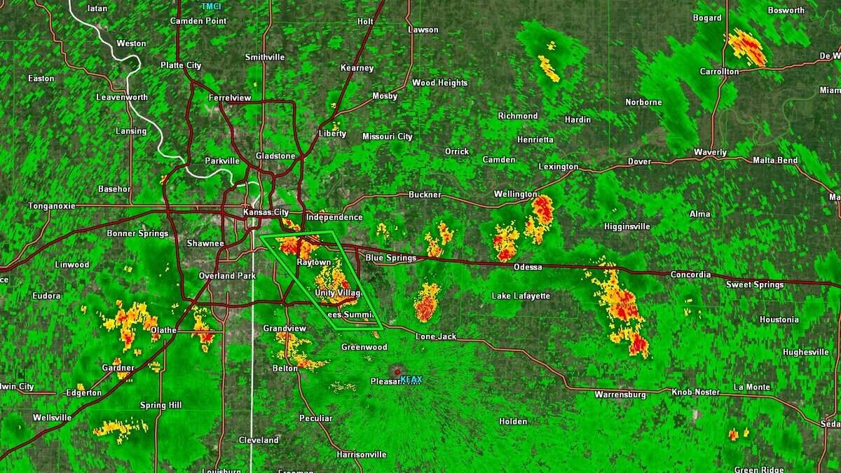
The National Weather Service has issued a flash flood warning for parts of the Kansas City metro after storms dumped up to 2.5 inches of rain.
The weather service issued the warning shortly before 1:50 p.m. for southwestern Johnson County. The warning is set to expire at 6 p.m.
At 1:49 p.m., radar indicated that thunderstorms were producing downpours in the area. Between 0.5 and 2.5 inches of rain had already fallen, and an additional 0.5 to 2 inches more was possible. The rain was falling at a rate of 1 to 3 inches per hour, the weather service said.
Flash flooding of small creeks, streams, urban areas, highways, streets and underpasses, as well as areas with poor drainage and low-lying areas, was possible.
Some of the locations in the path of the storm included Kansas City, Lee’s Summit and Unity Village.

The weather service urged drivers to turn around if they come across flooded roads. Most flood deaths occur in vehicles.
In a post on X at around 2 p.m., the weather service said scattered showers and storms are expected to continue during the afternoon across the region.
“These are capable of producing moderate to heavy rainfall,” the weather service said. “Over 2 inches of rain has fallen in the Lee’s Summit/Unity Village/Raytown area, prompting the issuance of a flash flood warning.”
The weather service has also issued flood advisories for parts of southwestern Clay and northeastern Jackson County, Johnson County, northwestern Miami , northwestern Cass and southwestern Jackson County, and northeastern Linn County, southeastern Miami County, northwestern Bates County and western Cass County until 5 p.m.
Some areas that could experience flooding include Kansas City, Independence, Blue Springs, Grain Valley, Oak Grove, North Kansas City, Sugar Creek, Buckner, Lake Lotawana, Lake Tapawingo, Levasy, Napoleon, Tarsney Lakes, Paola, Osawatomie, La Cygne, Drexel, Linn Valley, Fontana, Amsterdam, Merwin and New Lancaster.
