
Pop-up showers, storms possible in Kansas City area. Will you see rain?
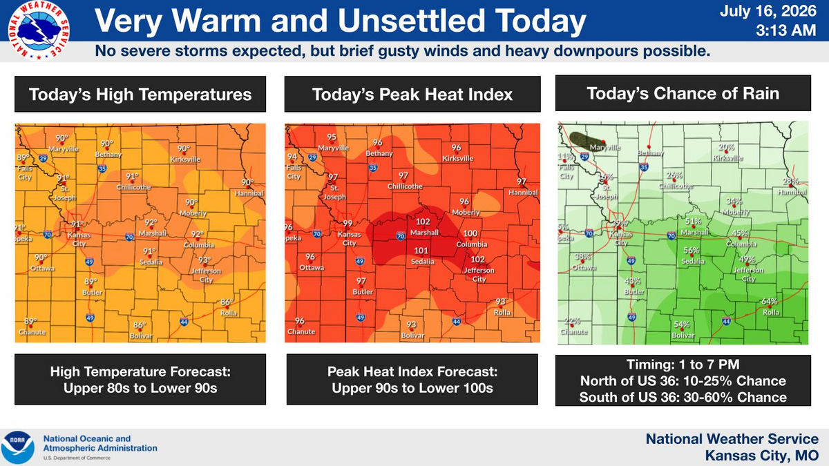
A few showers and thunderstorms might pop up Thursday afternoon and evening in the Kansas City area, but not everyone will see rain, according to the National Weather Service.
Forecasters said a surge of humid air will move north into the region.
“This will lead to isolated to scattered showers and storms generally as far north as I-70, but wouldn’t be surprised if a couple spilled north of I-70 as well,” the weather service said.
Severe weather isn’t expected. Any storms that form should be “garden-variety,” short-lived and fairly weak, the weather service said.
The storms are likely between 1 and 7 p.m., and could produce brief gusty winds. The slow-moving storms could also bring pockets of heavy rain, leading to isolated flash flooding.
Shower and storm activity should quickly drop off after sunset, the weather service said.
Temperatures on Thursday are expected to be around 90 degrees, with a heat index as high as 96 degrees. Kansas City’s normal temperature for this time of year is 89 degrees.
Temperatures and humidity will continue to gradually climb, reaching the low 90s on Friday and the low to mid-90s this weekend. Heat index values will reach the upper 90s to lower 100s Friday through the weekend.
Nightly storms could return Friday night through the weekend, but due to uncertainty about where the storms may develop or track, rain chances remain low, the weather service said.
Forecasters expect some relief from the heat to arrive next week, but not until it peaks on Monday..
“Monday looks like it could be our hottest day through this stretch, with actual temperatures warming into the upper 90s, near 100 degrees in many locations,” the weather service said. “With dew points staying in the low 70s, heat indices may get to 100 to 110 on Monday.”
There are signs that temperatures may ease a little, falling to the mid-90s on Tuesday and around 90 degrees on Wednesday and Thursday. Dew points will be lower, keeping the heat index near air temperatures, according to the weather service.
Rain chances could return later in the week as the weather pattern becomes more active.
