
Kansas City’s heat and humidity rise; will storms bring any relief?
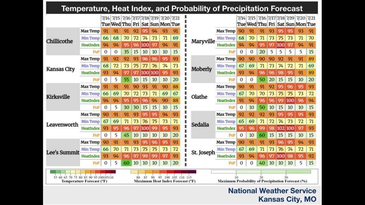
The heat is cranking up this week in Kansas City, and hit-and-miss storm chances are rising, too, according to the National Weather Service.
Tuesday will look a lot like Monday, with mostly sunny skies and highs in the upper 80s to low 90s across the region. That’s a degree or two warmer than Monday.
Forecasters expect temperatures in Kansas City to be around 90 degrees, slightly above the mid-July normal of 88 degrees. With relatively dry air today, the heat index should stay close to the actual temperature.
That starts to change on Wednesday as humidity builds. Temperatures will be around 91 degrees, and rising dew points could push heat index values into the mid- to upper 90s south of Interstate 70.
Moisture will continue to spread into the area on Thursday, bringing a 40% to 60% chance of showers and storms in the afternoon and evening, forecasters said. Any storms that form will be disorganized and short-lived. Most storms will not be severe, with the primary risk being damaging winds as the storms collapse.
“As we lose daytime heating during the evening, storm chances drop off with no rain expected overnight,” the weather service said. Temperatures are expected to be around 92 on Thursday, with a heat index around 97 degrees.
The weather pattern shifts late Thursday into Friday, and winds aloft help pull more moisture into Missouri, setting up a hotter, more humid weekend.
Temperatures will warm to the low to mid-90s on Friday, with heat index values in the mid-90s to near 100 degrees. Saturday’s heat index will be in the upper 90s to low 100s, with some spots nearing 105 degrees.
While rain chances remain slim to none on Friday, some computer models indicate there could be some nocturnal storms Friday night into early Saturday as well as Saturday night into early Sunday.
Temperatures will remain quite hot for the remainder of the weekend and the start of next week, around 96 degrees on Sunday and 95 degrees on Monday, with the heat index in the mid-90s to 100 degrees.
