
How much rain did your area get in KC’s storms the past two days? See rainfall totals
Parts of the Kansas City metro may be feeling waterlogged after Friday morning storms dropped just shy of 2 inches of rain.
The soaking is piling up. For the second consecutive morning, storms drenched the area, leaving some neighborhoods with nearly a month’s worth of rain over two days.
The heaviest totals from Friday morning’s storms were recorded in Shawnee: 1.76 inches at Shawnee Mission Parkway at Mill Creek, 1.56 inches at Tamahawk Hills Golf Course at Little Mill Creek and Woodland Road at Clear Creek, and 1.52 inches at West 75th Street at Kansas 7, according to data from StormWatch.com, a collection of rain gauges across the metro.
All totals reflect the 12 hours ending at 9 a.m. Friday.
Other notable amounts included:
- 1.48 inches at West 95th Street at Kill Creek in De Soto
- 1.4 inches at Johnson Drive and Kansas 7 in Shawnee
- 1.2 inches at Raytown Road and Round Grove Creek in Kansas City
- 1.16 inches at Blue Ridge Cutoff at Round Grove Creek in Kansas City and Johnson Drive at Turkey Creek in Merriam
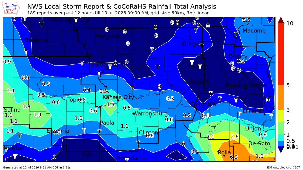
More KC area rainfall totals
Other parts of the Kansas City area saw little rain:
Kansas City International Airport (MCI) recorded .06 of an inch during that 12-hour period, according to an automated weather station system report.
Meanwhile:
- .22 of an inch at Kansas City-Lee’s Summit Regional Airport
- .45 of an inch in Clinton
- .88 of an inch in Sedalia
- St. Joseph reported no rain during that period
In Kansas:
- .26 of an inch fell in Lawrence
- .25 of an inch at New Century AirCenter in Olathe
- A trace at Johnson County Executive Airport in Olathe
Interactive map shows rainfall totals in KC area
Here’s an interactive map showing rainfall totals across the metro during that 12-hour period.
Two mornings of heavy rains have seen rainfall totals climb rapidly.
About 4.58 inches of rain is normal for July, and some parts of the metro have come close to that mark after back-to-back morning storms.
48-hour totals
The heaviest 48-hour totals (through 9 a.m. Friday) were concentrated in Shawnee and western Wyandotte County:
- 4.04 inches at Shawnee Mission Parkway at Mill Creek in Shawnee
- 3.96 inches at Woodland Road at Clear Creek in Shawnee
- 3.76 inches at the wastewater treatment plant near Interstate 435 and Kaw Drive/Kansas 32 in Kansas City, Kansas, according to StormWatch.com
Other notable 48-hour totals include:
- 3.4 inches at Johnson Drive and Kansas 7 in Shawnee
- 3.36 inches at West 75th Street and Kansas 7 in Shawnee
- 3.28 inches at Johnson Drive at Turkey Creek in Merriam
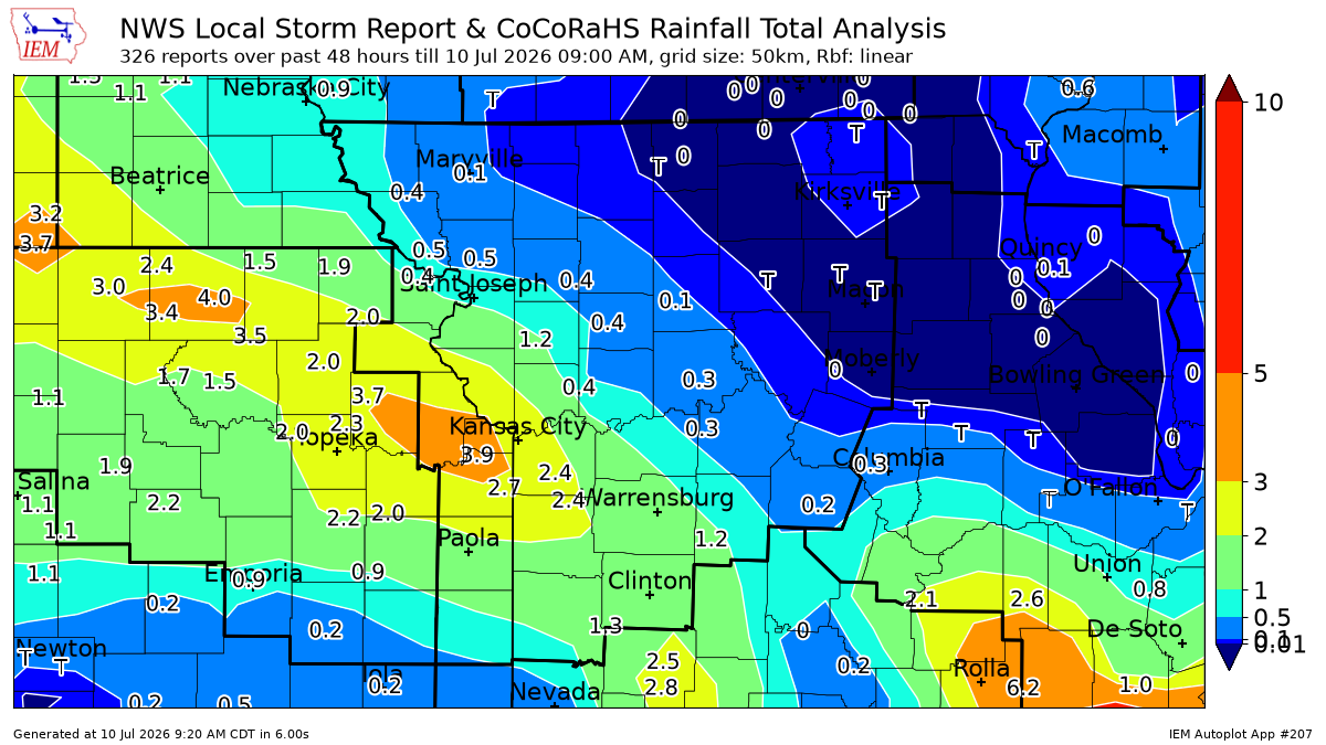
KCI measured about 1.3 inches of rain during the 48 hours ending at 9 a.m. Friday, according to an automated weather station system report.
Elsewhere:
- 2.19 inches at Kansas City-Lee’s Summit Regional Airport
- 1.24 inches in Clinton
- 1.28 inches in Sedalia
- .43 of an inch in St. Joseph
In Kansas, gauges reported:
- 1.34 inches in Lawrence
- 2.12 inches at New Century AirCenter in Olathe
- 1.30 inches at Johnson County Executive Airport in Olathe
Here’s an interactive map showing rainfall totals across the metro during that 48-hour period.
Another round of storms, some that could become severe, is possible Friday afternoon and evening.
