
Dry week, hotter days: When Kansas City’s worst heat is expected
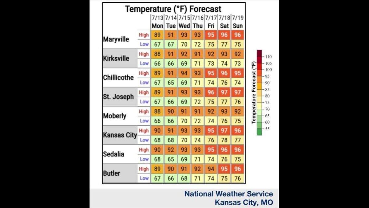
Summer heat is settling in across Kansas City. Near-normal July temps start the week, but they are expected to surge into the mid- to upper 90s by the weekend, according to the National Weather Service.
Temperatures on Monday and Tuesday should reach typical July levels across the region, in the upper 80s to lower 90s, the weather service said. The metro typically sees temperatures around 89 degrees this time of year.
Then a major warmup is forecast this week, with temperatures climbing through the week. Temperatures will creep into the lower to mid-90s Wednesday through Friday, the weather service said.
“The worst of the heat looks to be this weekend, where widespread highs in the middle to upper 90s are currently forecast,” the weather service said.
Humidity levels aren’t expected to be extreme, the weather service said.
“Nevertheless, dew point temperatures in the middle 60s to lower 70s, combined with the heat, will yield peak heat index values in the upper 90s to lower 100s Friday through Sunday,” the weather service said.
The metro area will also enter a dry stretch this week, with rain chances looking limited. Forecasters do not expect significant rainfall this week.
Some Gulf moisture may sneak northward into the lower Missouri River Valley, which could be enough to trigger a spotty afternoon shower or thunderstorms south of Interstate 70 during the hottest part of the day Wednesday and Thursday, the weather service said.
