
Severe weather risk rises for Kansas City; hail, tornadoes also in play
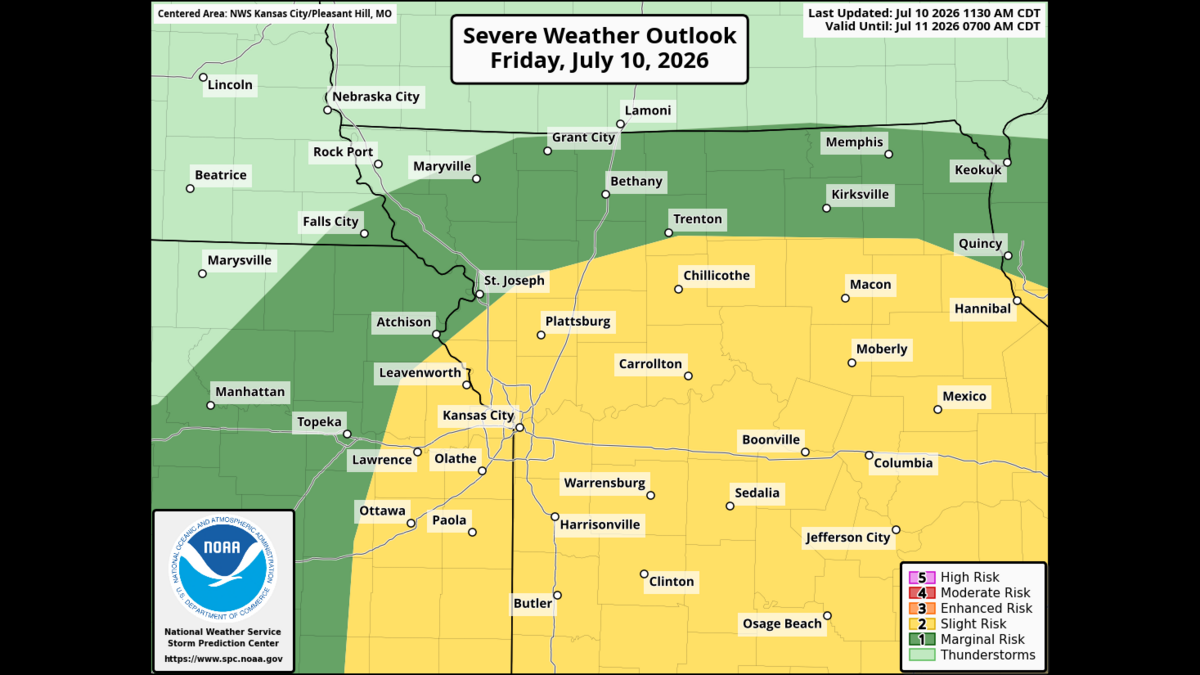
The risk of severe weather in Kansas City has increased as storms could fire up Friday afternoon, according to the National Weather Service.
Damaging winds and heavy rain are the primary threats, but hail and brief tornadoes can’t be ruled out, the weather service said in its latest weather briefing. Forecasters also warned that overnight storms could “train” over the same areas, dumping torrential rain and causing flooding.
There is still some uncertainty that remains in the forecast — mainly the exact timing and intensity of the storms, the weather service said.
Whether storms develop will depend on how quickly the atmosphere can “recharge” after Friday morning’s showers and storms, and how much warm, humid air can build through the day, leading to destabilization later, forecasters said.
Storms are likely to develop in the afternoon and evening, though the exact timing and location could shift. Forecast models suggest storms will pop up early afternoon in far northeast Kansas and northwest Missouri and expand as the storm system moves eastward, the weather service said.
Weather radar showed that, as of 1 p.m., storms were moving through far northeast Kansas and northwest Missouri.

At 1:26 p.m., the weather service issued a severe thunderstorm warning for the St. Joseph area, saying a severe storm was near Rushville, or 7 miles south of Wathena, Kansas, and was moving to the northeast at 30 mph.
The warning is in effect until 2 p.m. and the cities in the path of the storm include St. Joseph, Gower, Wathena, Elwood, Country Club Villa, Country Club, Agency, Rushville, Lewis and Clark Village, Doniphan, De Kalb, St. Joseph Airport and Faucet.
Storms may fire up a bit to the north or south, which would change who sees the worst weather. It’s also unclear whether the storms stay as isolated supercells or merge into a line or cluster, the weather service said.
The Storm Prediction Center has added Kansas City and much of eastern Kansas and most of Missouri to the area at a slight risk (Level 2 of 5) of severe weather. All severe hazards are possible, including damaging winds, heavy rainfall, hail and tornadoes.
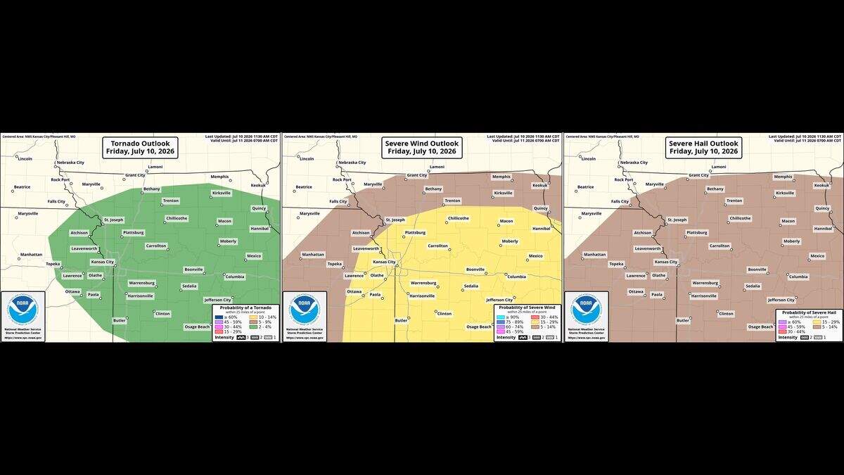
Earlier, Kansas City was only at a marginal risk (Level 1 of 5), and tornadoes were not anticipated.
The weather service advises folks to have multiple ways to receive weather forecasts and warning information.
