
Kansas City gets a wet start Friday; could stronger storms return later?
Early morning storms brought rain to the Kansas City area Friday, and forecasters say the rest of the day could swing from a quiet break to strong afternoon storms, depending on how quickly skies clear and temperatures rise.
Some storms dumped 1.5 inches or more of rain in parts of the metro, according to StormWatch.com, a network of rain gauges across the area.
The storms moved through the region ahead of the morning commute, prompting the National Weather Service to issue a severe thunderstorm warning for Johnson and Wyandotte counties, plus parts of Miami, Leavenworth, Cass and Jackson counties. The warning was issued around 4:40 a.m. and expired at 5:30 a.m.
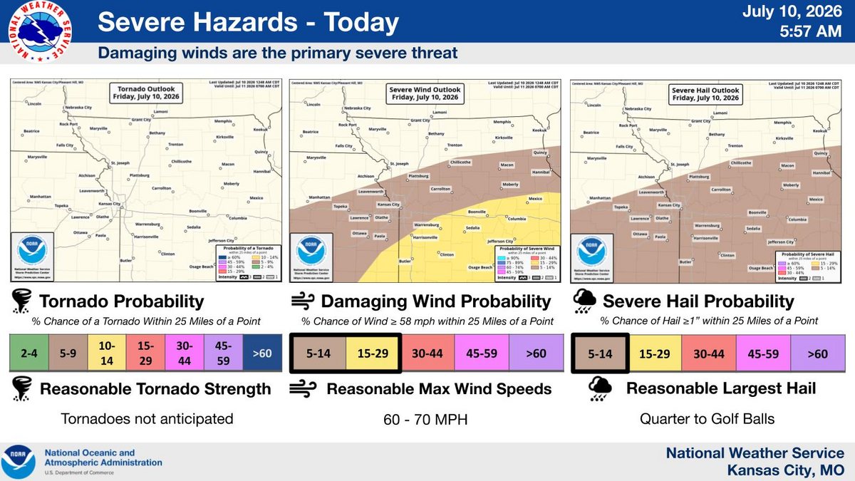
As the morning storms weaken and move east, forecasters will watch for new storms to redevelop Friday afternoon, mainly from western to central Missouri. Some of which could become strong to severe if the atmosphere heats up quickly, according to the weather service.
If strong storms form, the biggest risks are damaging winds up to 60 to 70 mph and quarter- to golf-ball-size hail. Heavy rainfall will also be possible, the weather service said. Tornadoes are not expected, forecasters said.
The Storm Prediction Center, part of the National Weather Service, has placed the Kansas City area under a marginal risk (Level 1 of 5) of severe weather. Meanwhile, areas to the southeast, including the Lake of the Ozarks area, are under a slight risk (Level 2 of 5).
Any storms that form should move out late Friday evening into early Saturday.

A few showers and storms could linger on Saturday, mainly southeast of Kansas City. The setup for stronger storms appears to be along Interstate 44 and into the Ozarks region, the weather service said.
Temperatures are expected to be in the mid- to upper 80s, which is around the metro’s normal of 88 degrees for this time of year.
A high-pressure system builds over the area next week, making the weather hotter and mostly dry. Temperatures will climb back into the 90s by the middle of the week. With dew points forecast to be in the upper 50s to the lower 60s, heat index values will be just a few degrees above air temperatures.
