After suspected tornadoes, KC area faces severe weather Tuesday; more this week
After suspected tornadoes struck Franklin and Miami counties Monday night, the Kansas City region faces the threat of more severe weather Tuesday, with additional storms possible Wednesday and Friday, according to the National Weather Service.
Before the storms, temperatures are expected to climb into the upper 80s in the metro, well above the normal 65 degrees for this time of year.
Storms could develop after the evening rush hour and into the night, most likely starting in southern Kansas and northern Oklahoma before moving northeast into the area, according to the weather service.
There is some uncertainty in the forecast. If storms develop closer to the Kansas City metro ahead of the more widespread activity in the evening, the risk for severe weather would increase, the weather service said.
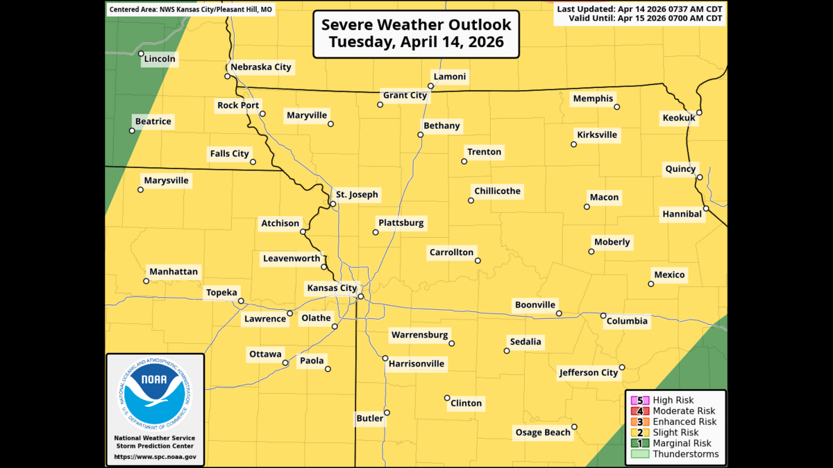
The main threats will be damaging winds and very large hail, although a tornado would be possible if any storm becomes a rotating thunderstorm, known as a supercell.
The National Weather Service’s Storm Prediction Center has placed most of the Kansas City region under a slight risk of severe weather, Level 2 of 5.
Additional rounds of less potent showers and thunderstorms are possible overnight Tuesday into Wednesday morning.

More strong to severe weather in forecast
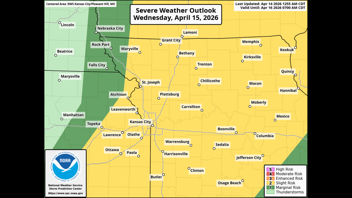
The risk of strong to severe storms continues Wednesday, but there is some uncertainty about how strong they will become.
Storm timing is expected to be in the afternoon to evening, according to the weather service. The region remains under a slight risk of severe weather.
There will be a brief break from the stormy weather on Thursday, but temperatures will remain warm.
‘Quite impressive’ setup for Friday
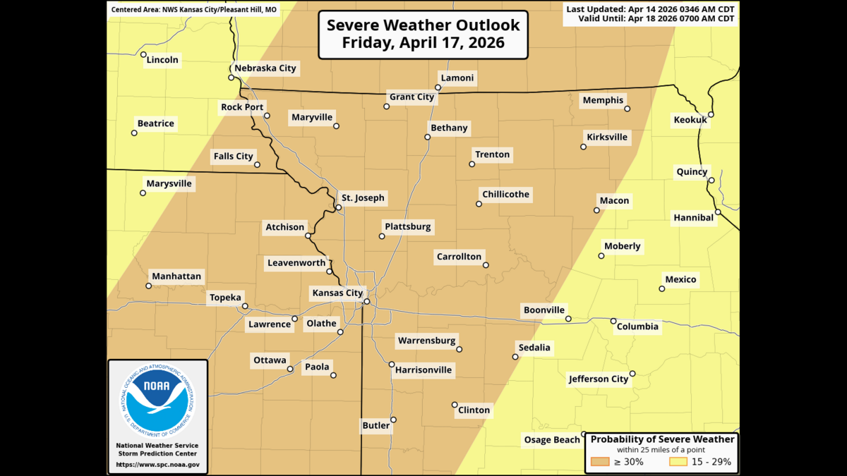
Friday will be a day to watch, with another round of strong to severe storms possible. The weather service said forecast guidance shows a “quite impressive” setup.
Details remain uncertain on where and when the worst storms will occur, but current guidance points toward mid-afternoon through the evening and into Friday night. The Storm Prediction Center’s Day 4 outlook shows a 30% chance of severe-weather area for the region, a level of concern often comparable to an enhanced risk, Level 3 of 5.
With the ground still saturated from recent rains, localized flooding is possible in spots over the coming days, the weather service said.
Temperatures will stay warm through the workweek. After Friday’s storms, cooler and quieter weather is expected for the weekend and early next week.