
Weekend weather whiplash: KC gets a taste of winter, but will snow even show up?
AI-generated summary reviewed by our newsroom.
- Weak system may bring only a dusting of snow to Kansas City, unlikely to stick.
- Cold front dropped temps into the upper teens; highs a few degrees below normal.
- Temps rebound to near 60 degrees Tuesday and upper 60s by Friday.
Don’t expect a winter wonderland this weekend as a weak winter system passes through the region. Kansas City’s best chance is for light snow — maybe just a dusting — and even that is unlikely to stick.
Folks who have gotten used to one of the warmest Februarys on record were in for a rude awakening Friday morning as a cold front ushered in much colder weather overnight, according to the National Weather Service.
Temperatures at Kansas City International Airport dropped into the upper teens early Friday, and a biting wind made it feel even colder — around 7 degrees at 6 a.m.
Temperatures are expected to rebound through the afternoon, although most locations will remain a few degrees below normal. The metro is expected to see a high of around 41 degrees, just shy of the average of 45 degrees for late February in Kansas City.
The light snow is expected to move into the area Saturday morning, the weather service said.
“Best chances for any amount of snow reside over western Missouri and into Kansas, and chances for a half inch of snow or more quickly go to just about zero across the state (of Missouri),” the weather service said.
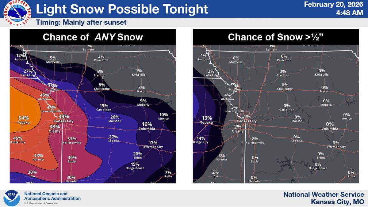
The reason for the low snow chances is that the weather system will struggle to squeeze out much moisture from an already dry air mass.
The snow could spoil Kansas City’s run for a rare snowless February. The only time the metro saw no measurable snow in February was in 1892, although several years have had only a trace.
Below-normal temperatures are expected to continue into the start of next week, with temperatures reaching around 41 degrees on Saturday, 38 degrees on Sunday, and 36 degrees on Monday.
Temperatures will then quickly rebound on Tuesday, climbing to near 60 degrees. They are expected to remain above normal for the remainder of the week, reaching the upper 60s by Friday.
