
What could have been done to control the Flood of 2019?
READ MORE
The never-ending flood
A video chronicle of the events and the stories of survivors of this year’s catastrophic flooding along the Missouri River.
Expand All
The river here is different than the river there
The starting point of the Missouri River is near Three Forks, Montana.
But for people who live in the lower Missouri River Basin, it might as well begin about 800 miles to the southeast on the South Dakota-Nebraska border, where the water flows out of Gavins Point Dam
Gavins Point also may be the place where opinions about the U.S. Army Corps of Engineers start changing from “the builders of great dams” to something less positive.
From its headwaters the river flows through Montana, North Dakota and South Dakota. Along the way it is tamed by six Army Corps of Engineers dams that create six reservoirs open to boating, fishing and other outdoor recreation. They are also sources of hydroelectric power.
The dams hold back more than 72 million acre feet of water. That’s enough to cover the entire state of Missouri in a more than a foot of water - all 45 million acres of it. The dams are also at the core of the Missouri River flood control system established by the Corps 75 years ago.
South of Gavins Point is a different picture. The Missouri is flanked by mostly earthen levees, and in some places it looks more like a drainage canal than a natural river as it makes its way to the Mississippi.
There is recreation on the lower Missouri, but swift currents due to the channeling influence of the levees can make being on the river dangerous.
Decisions made by the Corps on how much water flows out of the reservoirs and when it flows have major, and sometimes catastrophic, effects on the stakeholders along the lower portion of the river. For people living along the Missouri, those decisions are key in shaping their opinion of the Corps of Engineers.
Those decisions usually go unnoticed until the river is overtopping levees and floodwaters are covering farmers’ fields.
The Corps rarely gets recognized for the disasters it diverts.
A lot of people to please
The Corps’ management approach is spelled out in a document called the Master Manual. It’s a rule book of sort with rules that have been shaped by groups with some direct interest in the management of the river. Sometimes their interests can seem to be in direct conflict.
The river management plan is complex. The Corps has to constantly monitor weather conditions across the entire Missouri River basin and be aware of the potential runoff from snowpack in the mountains with streams that eventually drain into the Missouri. They also use dams along the Missouri’s tributaries to manage the flow of the river.
Flood control was the original purpose for the dams along the Missouri and its tributaries. That mission has evolved over the years to include restoring and protecting the natural habitat of certain wildlife that live in and along the river.
Two river residents, a bird, the interior least tern, and a fish, the pallid sturgeon, are listed as endangered species. Another river bird, the piping plover, is listed as threatened. Their protection plays a significant part in the Corps’ decisions on how much and when to release water from Gavins Point.
Another priority in the Corps’ Master Manual is river navigation. Barges loaded with grain and minerals still travel up and down the Missouri River. The Corps is required to maintain adequate flows to keep traffic moving.
Then there is flood control. It used to be the only thing on the Corps’ “to do” list. Now it is one of many missions, according to the Master Manual.
One of the measures the Corps has taken to comply with that part of their mission is to slow the flow of the river in an effort to prevent erosion along its banks in areas that are important breeding grounds for wildlife.
Critics of the Corps, many who were directly affected by 2019’s flooding, claim the agency has chosen protection of wildlife over protecting human lives and property. They say the Corps’ methods have changed the behavior of the river.
A group of landowners, farmers and business owners along the river filed a lawsuit against the Corps claiming that the changes in their management methods has directly contributed to more frequent and severe floods.
The Corps of Engineers prioritized habitat restoration and protection with the Missouri River Recovery Plan in 2004. The lawsuit, initially filed in 2014, claimed that there were major flood events along the river in seven separate years following the change.
A judge ruled in favor of the plaintiffs in 2018, saying that expert testimony had shown that the changes the Corps’ implemented had a direct effect on causing the river to rise higher, flood more often, more severely and at greater duration.
Supporters of the wildlife preservation say those who maintain that flood control efforts should supersede all other aspects of the river’s management are wrong.
There is also grumbling from lower river stakeholders who believe that the Corps prioritizes keeping the levels at flood control reservoirs consistent to attract recreational users, instead of lowering or raising them in response to flood control needs.
Record shattering weather
In a normal year, management of the Missouri River is complex. This year has been anything but normal.
According to the National Weather Service, 2019 has been the wettest year on record. The water year is measured from October 1 to September 30. In that time frame from late 2018 to 2019 gauges for Kansas City recorded 57.88 inches of precipitation. The total topped the previous record set in 1961. The average for Kansas City is 38.86 inches. Much of the Missouri River Basin experienced the same wet conditions.
A relentless winter was capped off with back-to-back “bomb cyclones” that dumped feet of snow and rain in the middle of the basin in March and April. Runoff from the March storm helped bust open the Spencer Dam on the Niobrara River, a tributary of the Missouri in northern Nebraska, and send a torrent of water and ice downstream to Lewis and Clark Lake behind Gavins Point Dam.
U.S. Army Corps of Engineers Missouri Basin chief John Remus said that if the lake were completely empty, the runoff from the storm could have filled it twice.
To keep Gavins Point Dam from bursting, the Corps was forced to open the control gates wider to relieve the pressure. The flow was increased from a modest 22,000 cubic feet per second to a roaring gush of 100,000 cfs in a single day.
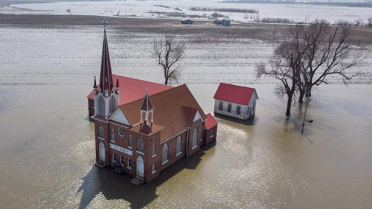
Billions of gallons of water was added to the Missouri River which was already at extreme levels and overtopping protective levees before the release according to the Corps. Within two weeks, virtually every recorded levee between Council Bluffs and Kansas City had failed or had been overtopped.
The flooding in Nebraska, Iowa and Missouri was catastrophic. People died.
Weeks later, after the second “bomb cyclone”, the river rose again. This time, with levees still broken, the damage was swift.
All this and the snowmelt that fills the northern lakes in the spring had barely started flowing out of the mountains.
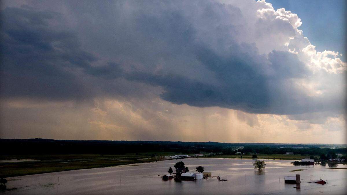
Relentless thunderstorms throughout the month of May pounded Kansas, Nebraska, Iowa and Missouri, filling local tributaries of the Missouri River to set off another round of floods. The levees were still down.
Areas along the Missouri River east of Kansas City may have dodged a bullet when rains tapered off just in time to save the Corps from possibly opening control gates on the dam at Tuttle Creek Lake near Manhattan, Kansas.
The lake was quickly rising to a record level set by the Great Flood of 1993, when control gates were opened to make room for more runoff. The torrent flowed into an already engorged Kansas River which made its way to the Missouri and amplified flooding that had already reached catastrophic proportions.
When the water level crested in Tuttle Creek on May 31 of this year it was less than two feet away from the 1993 mark. The Corps had been using a smaller outlet to lower the lake, but if the storms hadn’t stopped it’s likely the giant control gates would have had to be opened.
On June 1, a day after Tuttle Creek crested, National Weather service data shows the Missouri River at Waverly, Missouri, east of Kansas City was at an all-time record crest of 31.92 ft. That level was reached without the potential surge that could have come if the gates at Tuttle Creek were opened.
By late summer, it seemed like things were starting to dry out and repairs could begin on some levees. Portions of Northwest Missouri and southern parts of Nebraska and Iowa were still flooded.
The river was still above flood stage in many places due to the release from Gavins Point. The Corps was desperately trying to lower lake levels that were still elevated from snowmelt and continued precipitation.
According to the National Weather Service, in September parts of North Dakota received 300 to 500 percent of their normal rainfall for the month due to record-setting storms. The river rose again. A repair to a levee in Holt County, Missouri, that cost millions of dollars was nearly wiped out due to the surge.
What is normal?
It’s late November and levees are still in disrepair. Water still stands in fields outside of compromised levees. Soaked and swollen grain that burst storage bins remains rotting on the ground.
The Corps has started to ratchet down the release of water from Gavins Point. The river may finally drop below flood stage for the first time in eight months.
It may be too soon to say things are returning to normal along the Missouri. Broken or weakened levees still leave some areas vulnerable to flooding. Federal aid to help rebuild farms and homes hangs in limbo due to a federal disaster declaration that doesn’t cover damage caused by the earliest days of the flood.
Farmers who didn’t plant or harvest a crop in 2019 are uncertain whether they will have a crop to harvest in 2020.
The wettest year on record has some wondering if the Flood of 2019 could be a symptom of climate change and if so, does that mean normal is being redefined?
Could the Corps of Engineers have done more to lessen the impact of the Flood of 2019?
Since last year, weather has been so severe the Corps says it’s only been focused on flood control.
The Corps’ Missouri Basin chief John Remus points out that the Missouri Basin’s flood control system is based on data from the Flood of 1880.
“We are managing more water than it was designed to manage,” Remus said.
This story has been updated to correct the capacity of the flood control reservoirs and to clarify that levees were already being overtopped before the major release from Gavins Point in March.
BEHIND THE STORY
MOREAbout this series
The visual journalists of The Kansas City Star were on the scene with cameras when flooding started along the Missouri River last March. They have been out every month since then capturing stunning images along the river and gathering the stories of people impacted by the months-long flood. The result is this two-part series that showcases a collection of video stories that take us into the conflicts brought about by attempts to control the flooding and the hardships that ensue when the flooding is out of control.
Executive producers: Chris Ochsner, Todd Feeback
Producers: Todd Feeback, Xian Chiang-Waren
Videographers: Tammy Ljungblad, Rich Sugg, Jill Toyoshiba, James Wooldridge, Xian Chiang-Waren
This story was originally published November 26, 2019 at 5:00 AM.