What’s at Crown Center, and what will change with Royals move? These maps give an idea
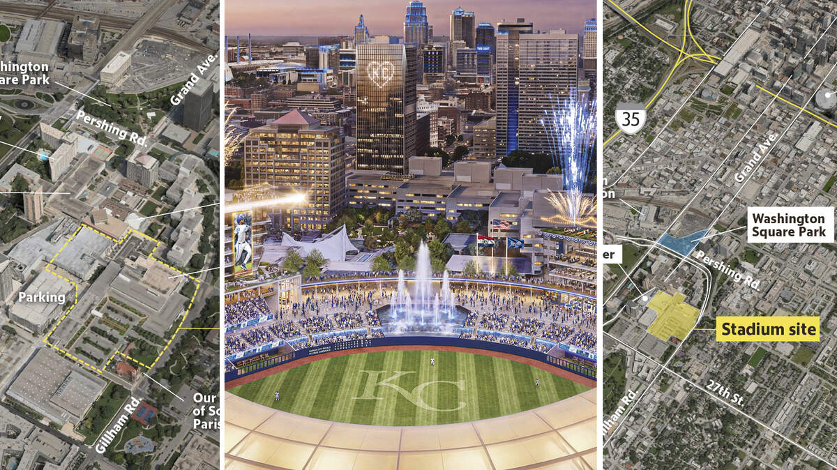
The Kansas City Royals announced on Wednesday plans to build a new ballpark at Crown Center — the 85-acre mixed-use district near downtown Kansas City — as part of a partnership with Hallmark Cards.
Crown Center’s architecture, layout and very existence are so distinctive — as a planned, mixed-use district with modern buildings surrounding a public plaza — that the area is listed on the National Register of Historic Places.
The announcement came just days after city officials passed an ordinance authorizing city manager Mario Vasquez to negotiate a deal worth up to $600 million towards a new stadium in “the Washington Square Park/Crown Center area.”

The construction of the stadium and surrounding district — expected to cost roughly $1.9 billion — will rely on a public investment from Kansas City and the state of Missouri. Whether Jackson County officials will contribute is not certain.
Washington Square Park would be included in the stadium district in some capacity.
What will the development mean for Crown Center?
A look at maps of the current area and the renderings released Wednesday show what is located at the site now, and what may change.
Royals stadium site


Hallmark buildings to be removed
According to renderings presented today, Hallmark’s headquarters and part of its visitor center would be removed to make way for the stadium.
The Ice Terrace and Our Lady of Sorrows Parish would remain.

Easy highway access, streetcar link, surrounded by key landmarks
The site would be accessible via U.S. 71, I-35 and I-70, along with streetcar service along Main Street.
The stadium would be surrounded by nearby landmarks such as the Liberty Memorial, Union Station and the Power & Light District to the north.
One rendering shared Wednesday indicated a zone around the proposed stadium that would be within a 10-minute walk.

The Star’s Chris Higgins, Kacen Bayless and Sam McDowell contributed.
This story was originally published April 22, 2026 at 1:55 PM.