
Blast of cold air coming to Kansas City: Just how bitter will temperatures get?
Spring-like weather will continue for the rest of the work week in Kansas City, but the first cold blast of the season is just around the corner, bringing much colder temperatures by Sunday.
Warmer-than-normal and dry weather is expected to continue through Thursday afternoon, with temperatures forecast to reach near 70 degrees, according to the National Weather Service.
However, clouds will increase, and wind gusts could reach as high as 24 mph. The cloud cover could impede daytime heating, keeping temperatures north of Interstate 70 in the mid- to upper 60s, while areas to the south of I-70 could be warmer, according to the weather service.
The chance of rain increases Thursday evening ahead of an approaching cold front. Light showers, mainly east of Interstate 35 and north of I-70, will be possible, the weather service said. No severe weather is expected.
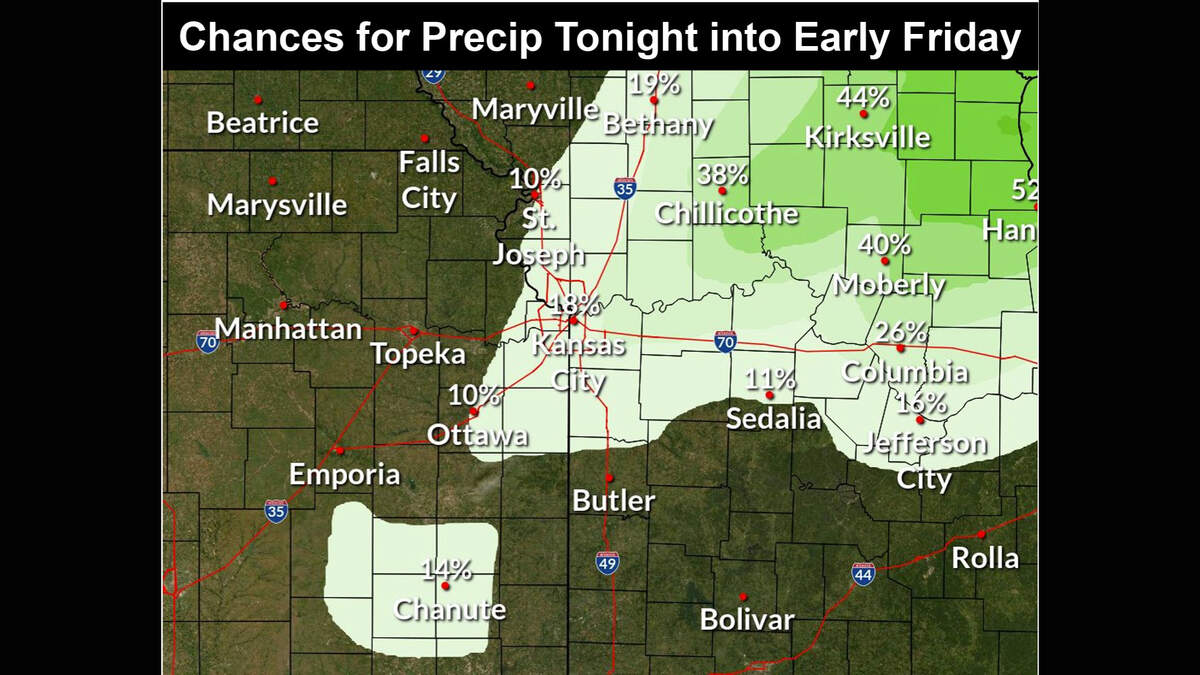
“Some rumbles of thunder will be possible, but given the generally unfavorable environment for storms . . . any storms that form are expected to remain isolated in nature,” the weather service said in its forecast discussion.
Rainfall totals are expected to remain below a tenth of an inch.

The cold front is expected to move through the area on Friday. Because the colder air will lag behind, daytime temperatures will remain above seasonal averages, ranging from the mid-60s to the low 70s across the region.
In the metro, temperatures are expected to be around 70 degrees. Typically, Kansas City’s average high temperatures is 58 degrees this time of year.
Coldest morning coming Monday
“Going into the weekend, temperatures will trend cooler due to the effects of the cold front, ranging in the mid-50s to mid-60s,” the weather service said.
On Saturday, temperatures are expected to reach 63 degrees in the metro area. The weather service said there will be an additional chance for rain in the afternoon and evening, primarily for northeast Missouri.
Another cold front is expected to move through the area, bringing much colder air. Overnight temperatures will sink into the 20s. Temperatures on Sunday will struggle to rebound, climbing to only 40 degrees.
“The coldest morning this week will come Monday as lows sink into the upper teens to low 20s,” the weather service said.
After climbing to around 45 degrees on Monday, temperatures are expected to rebound on Veterans Day, reaching around 63 degrees.
