
Will rain dampen your weekend plans in Kansas City? Here’s the latest forecast
Kansas City will see off-and-on rain and cooler-than-usual weather this weekend as a sluggish storm system moves through the region, according to the National Weather Service.
Scattered showers are expected Friday, with the best chances of rain being south of a line from St. Joseph to Sedalia, the weather service said. Areas to the east and north of that line are expected to see less rain and possibly drier air.
Temperatures will be in the upper 50s, which is below the metro’s average of 64 degrees for this time of year.

The rain is expected to weaken during the evening, leading to a break or possibly a transition to drizzle. Accumulating rain will most likely be along and south of Interstate 70, the weather service said. Rainfall totals Friday evening will generally be less than .10 of an inch of rain. Winds will be out of the southeast at 5 to 10 mph, and temperatures will be in the lower 50s.
Rain chances continue into the weekend, especially for areas south of I-70, which includes the southern parts of the metro and areas further south. The weather service said the rain will be off and on, so there will be dry periods. Clouds will stick around, keeping temperatures cooler than usual.
On Sunday, the rain might not be as widespread as on Saturday, but occasional showers are still possible. No severe weather is expected from the storm system.
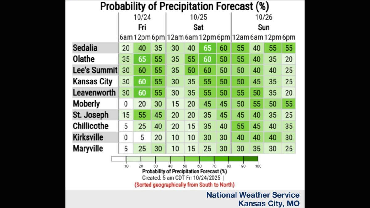
Heading into next week, there is a chance for more rain, which is much needed as much of the region is facing drought conditions, the weather service said.
“With abundant cloud cover and periodic chances for rain, temperatures look to be relatively cool for this time of year,” the weather service said in its forecast discussion.
There is a chance for drier weather later in the week, but the forecast remains uncertain as additional small weather disturbances could still bring rain.
