
Kansas City braces for mid-week storms, heavy rains
An active weather pattern is expected to ramp up in the Kansas City area later this week, bringing multiple chances for showers and thunderstorms, heavy rains, and possible flooding through Easter weekend, according to the National Weather Service.
But before the storms move in, the metro will see sunny skies and temperatures around 66 degrees, which is typical for this time of year in Kansas City. Winds are expected to be breezy, with gusts around 20 mph.
Temperatures will begin warming up on Wednesday, climbing to around 72 degrees in the afternoon.
There is potential for some weak showers developing over northern Oklahoma into Kansas and drifting eastward into Missouri.
“Nothing more than some passing showers through the day,” the weather service said.
Strong to severe thunderstorms in Kansas City’s forecast
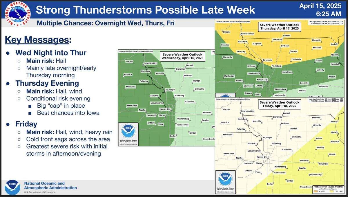
There are multiple chances for a few strong to severe storms in the region beginning overnight Wednesday into early Thursday.
The National Weather Service’s Storm Prediction Center has placed the western part of the Kansas City area under a marginal risk of severe weather, with hail being the main risk.
Temperatures are expected to climb into the mid-80s on Thursday.
The weather service said the chance of severe weather will fire up again Thursday evening as more storms are possible, especially in northern Missouri and Iowa.
The metro is under a marginal risk of severe weather, while areas north of St. Joseph are under a slight risk, according to the Storm Prediction Center.
The main threat from these storms will be hail and strong winds, the weather service said.
Heavy weekend rains, flooding
The best chance for severe weather in the area will be Friday night into Saturday as a cold front moves in and possibly stalls over the region. There is a 15% chance of strong to severe weather southeast of the metro.
The main risks are hail, wind and heavy rain. The weather service said the greatest risk of severe weather will be with the initial storms in the afternoon and evening.
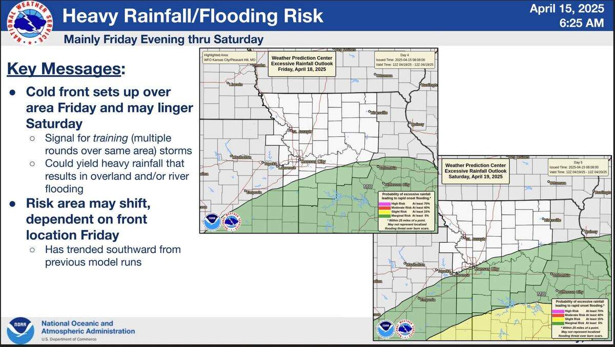
If the cold front sets up over the area Friday and lingers into Saturday, multiple storms with heavy rains could pass over the same location, leading to flooding.
The National Weather Service’s Weather Prediction Center has placed areas south and southeast of the metro under a marginal risk of excessive rainfall, leading to a rapid onset of flooding on Friday.
On Saturday, the metro is included in a marginal risk of excessive rainfall. The Lake of the Ozarks and areas to the south are at a higher risk.
The weather service noted that the risk may shift depending on where the cold front sets up, which has been trending southward from earlier forecast models.
Showers and thunderstorms are likely on Easter Sunday. The chance of precipitation is 60%.
This story was originally published April 15, 2025 at 7:44 AM.
