
Thunder shook Kansas City as strong thunderstorms pushed across area. How much rain fell?
It was a noisy night in Kansas City as strong to severe thunderstorms pushed through the area, causing rumbles of thunder and downpours of rain.
Kansas City’s Northland saw the heaviest rains, according to rainfall data from Stormwatch.com, which collects information from automated rain gauges across Kansas City.
Just shy of 1.5 inches of rain fell at Northwest 68th Street and Line Creek in the 12 hours ending at 6:15 a.m. Nearby, 1.41 inches fell on Interstate 29 at Line Creek. And 1.38 inches of rain fell on Missouri 152 highway at Upper Shoal Creek.
Meanwhile, areas south of the Missouri River saw less than .25 of an inch of rain.
Hot, muggy weather
The overnight storms have exited the Kansas City area, leaving behind what will be a mostly sunny day, the National Weather Service said.
“It will be hot and muggy today (Thursday) with heat index readings possibly surpassing 100 degrees south of Interstate 70,” the weather service said.
Temperatures will range from the upper 80s in northern Missouri to the middle 90s, stretching from Linn County, Kansas, to the Truman Lake area in Missouri.
Kansas City’s temperatures are expected to reach the low 90s. Typically, they are around 88 degrees at this time of year. The heat index is expected to be above 100 degrees.
Storms redevelop in afternoon
Another round of thunderstorms might redevelop in the afternoon and evening, mainly across portions of Missouri. The weather service said some of the storms could become severe.
The storm threat, however, is “highly conditional and uncertain,” the weather service said.
“If storms are able to redevelop, isolated instances of large hail and damaging winds would be possible,” the weather service said.
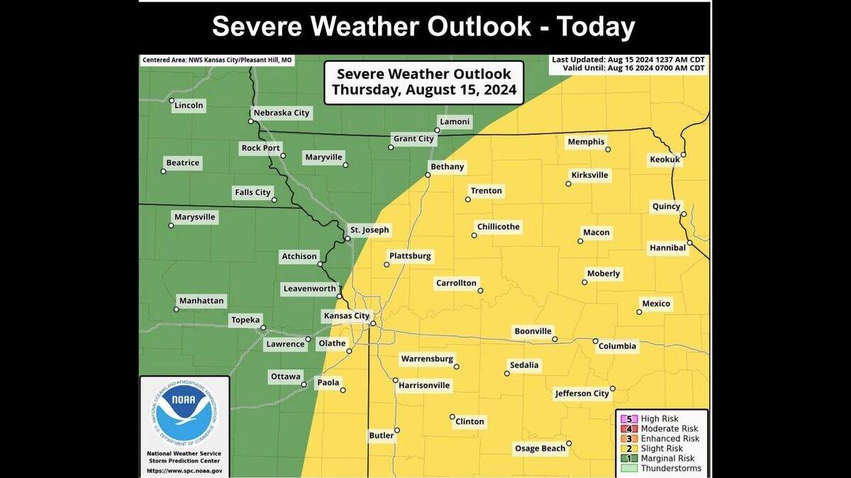
The weather service’s Storm Prediction Center has included Kansas City and most of Missouri in an area at a slight risk of severe weather.
Scattered storms will again be possible Friday evening and night south of Interstate 70. The weather service said a few strong to severe storms would be possible, with briefly strong gusty winds and marginally severe hail as the primary threats.
“Widespread heavy rain is not expected today through tomorrow, though locally heavy downpours will occur with the stronger storms and could still produce brief flooding issues,” the weather service said.
Temperatures are expected to be expected to be normal on Friday.
Sunny weekend ahead
The weekend looks rather pleasant, with mostly sunny skies and near-normal temperatures.
There is a slight chance of showers and thunderstorms overnight Saturday. Rain chances are around 20%.
“Saturday through Wednesday looks like a generally less active period,” the weather service said. “Highs each day will be in the 80s.”
This story was originally published August 15, 2024 at 7:38 AM.
