
Hard freeze settles across Kansas City area. Will Royals’ baseball home opener be as cold?
Drivers headed to work or morning errands likely found frost on the windshields of cars parked outside Wednesday after overnight temperatures plunged into the 20s.
A hard freeze settled across the Kansas City region, with temperatures at Kansas City International Airport falling to 23 degrees shortly before 6 a.m. The wind made it feel much colder as the wind chill temperatures tumbled to the mid-teens.
The National Weather Service had issued a freeze warning for the entire Kansas City area through 9 a.m.
For those wondering if Kansas City faces the possibility of more plant- and crop-killing cold weather, historically no, according to the weather service.
“On average, the last hard freeze (28 degrees or colder) for Kansas City occurs on 3/27,” the weather service said Tuesday on X, formerly Twitter.
So if Wednesday morning’s hard freeze is the last of this season, “we’ll be right on target,” the weather service said.
Temperatures will gradually warm throughout the day. Despite mostly cloudy skies, the Kansas City area is expected to reach about 51 degrees. Typically, Kansas City sees a high temperature of 60 degrees this time of year.
Overnight temperatures will not be as cold, but they will still approach freezing.
Opening day at the K forecast
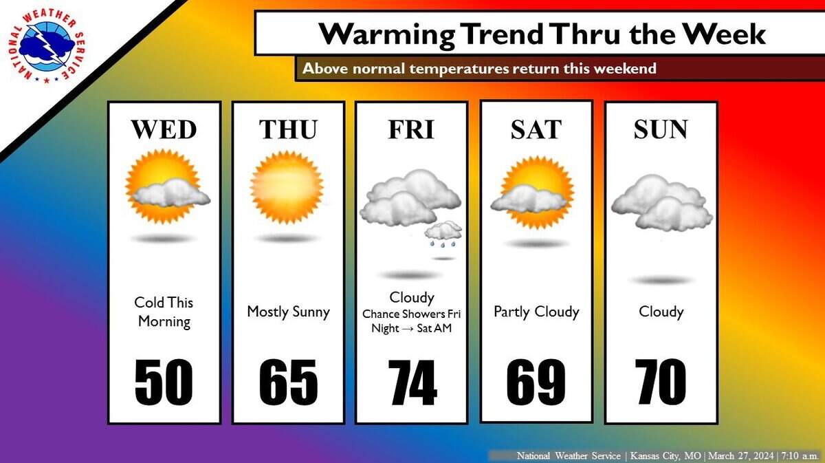
Much warmer temperatures will arrive Thursday, certainly to the delight of baseball fans cheering on the Kansas City Royals at the team’s home opener against the Minnesota Twins at Kauffman Stadium.
Although the day will start chilly, with temperatures in the mid-30s, they are expected to quickly warm up to the mid-50s by noon, according to the weather service.
At the time of the first pitch, which is scheduled to start shortly after 3 p.m., the temperature is expected to be in the low to mid-60s. The winds will be light to breezy, with gusts around 20 mph. The skies are expected to be sunny.
Above-normal temperatures are expected to continue into the Easter holiday weekend, with temperatures in the mid-70s on Friday and the upper 60s on Saturday and Sunday. There is a chance of showers on Sunday.
The unseasonably warm weather continues into next week, with temperatures expected to be in the low 70s on Monday. There is also a chance of showers and thunderstorms.
The extended outlook shows that near-normal temperatures and above-normal precipitation are expected for the first week of April.
This story was originally published March 27, 2024 at 7:39 AM.
