Kansas City just had one of its hottest Februarys in 136 years. Will storms cool us down?
After a balmy February and start to March, late-week rains are expected to cool down the Kansas City area, but not for long.
Heavy rain is expected on Thursday and Friday of this week, according to the National Weather Service in Kansas City. While there could be gusty winds, small hail and heavy downpours, flash flooding is unlikely because the metro has received little precipitation in recent months.
On Friday and Saturday, the high and low temperatures are expected to drop to the normal range for this time of year: highs around 50 and lows around 30, Brad Temeyer, a meteorologist with the National Weather Service in Pleasant Hill, told the Kansas City Star on Wednesday.
However, things will heat up next week, with temperatures in the 70s.
“It could be even warmer than that,” Temeyer said.
“We’re not expecting anything in the way of hazardous weather here in the next seven days,” Temeyer added.
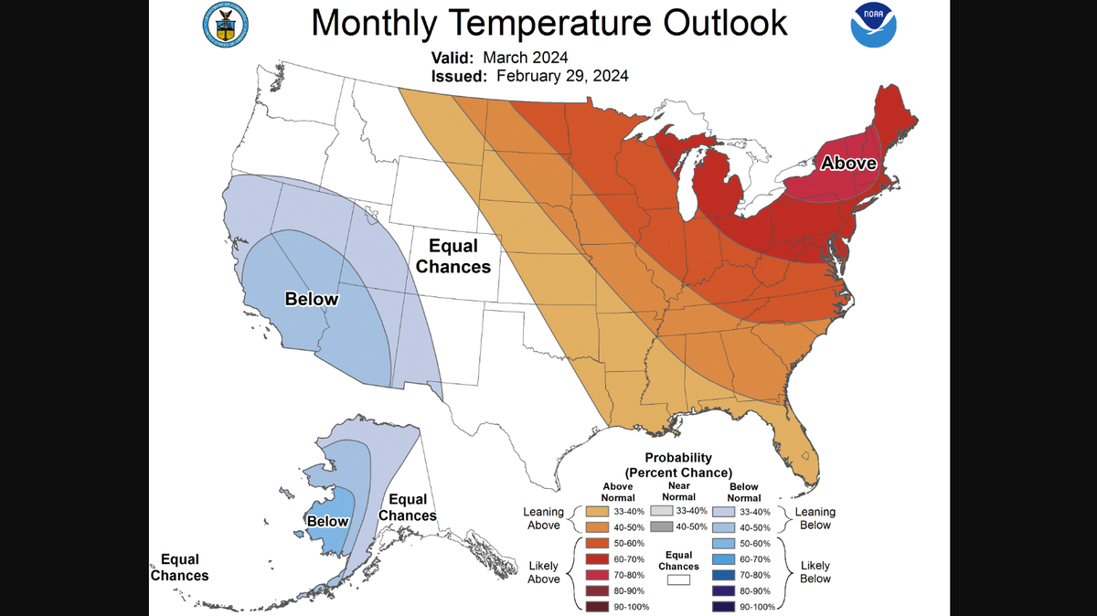
More likely than not, Kansas City will experience higher than normal temperatures throughout March, according to the Climate Prediction Center. From March through May, there is an equal chance of temperatures being higher or lower than average.
Out of the 136 years on record, February 2024 was the third hottest February in Kansas City, according to the Weather Service. March started warm as well. Kansas City hit 80 degrees on Sunday, the fifth earliest time on record to hit that mark.
Temeyer said the warm February was caused by warm air from the current El Niño climate pattern and the lack of snow cover to cool down the area. He also said it was too soon to understand if the warm month was related to climate change.
This story was originally published March 7, 2024 at 6:00 AM.