
Next chance for rain for Kansas City area comes Friday. Here’s when, how
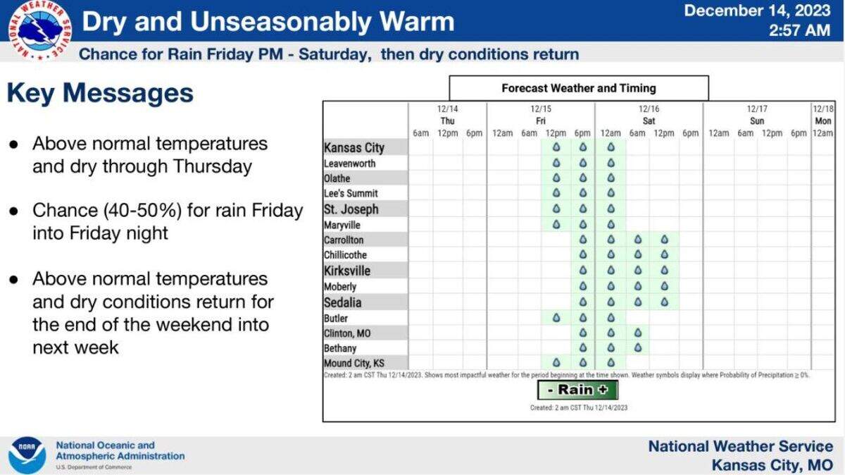
There’s a chance the Kansas City area will get some rain to close out the workweek, but don’t count on too much, according to the National Weather Service.
But before the storms arrive, Kansas City will see temperatures climb into the low to mid-50s on Thursday and Friday. Normally, the metro area’s temperatures for this time of year reach into the low 40s.
Even overnight conditions will be considerably warmer with temperatures dropping to the upper 30s to around 40 degrees. Typically, temperatures drop into the mid-20s this time of year in Kansas City.
Storms are expected to move into the Kansas City area Friday afternoon and evening and continue into Saturday. There’s a 40 to 50% chance for patchy light rain Friday evening into Saturday, the weather service said.
The rain is expected to be on the meager side, with only minor accumulations likely. Between .01 and .25 of an inch of rain is expected at Kansas City International Airport, according to the weather service.
Conditions will be slightly cooler under partly sunny skies on Saturday, although temperatures will still hover a few degrees above normal at around 50 degrees.
Above normal temperatures and dry conditions are expected to return on Sunday and continue into next week.
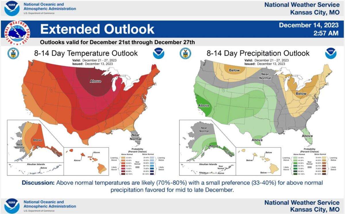
Looking ahead to the days leading into the Christmas holiday, warmer than usual temperatures are expected for the upcoming holiday weekend and beyond. There’s a 70 to 80% chance that temperatures will be above normal between Dec. 21st and 27th. Typically, temperatures are around 40 degrees during that period.
The precipitation outlook is leaning towards above normal precipitation, but that is a small preference of 33 to 40% chance, according to the weather service.
This story was originally published December 14, 2023 at 8:20 AM.
