
Rain shower, thunderstorm chances continue in KC area; severe weather holds off a day
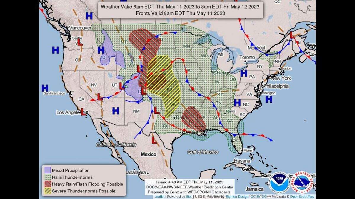
Showers and isolated thunderstorms will be possible in the Kansas City area through weekend with the next threat of severe weather more probable on Friday, according to the National Weather Service.
Scattered showers and isolated thunderstorms are expected to develop and spread northward across much of the Kansas City area on Thursday, the weather service said. None of these storms, however, are expected to be severe. The chance of precipitation is 80% in downtown Kansas City.

A round of severe storms are expected to develop over western Nebraska and western Kansas. As they move east, they are expected to form into a line that will approach the Kansas City area overnight Thursday into Friday morning. The storms, however, are expected to weaken as they approach the state line, the weather service said.
The chance for severe weather in the Kansas City area is low, however there could be isolated strong wind gusts, according to the weather service.
Cloud cover and the storms are expected to keep temperatures in the mid-70s on Thursday. It will be much warmer on Friday as temperatures are expected to climb into the mid-80s.
Thunderstorms are expected to develop over northeast Kansas and far northwest Missouri afternoon and spread eastward into the northwest Missouri.
Severe weather will be possible in the strongest storms. Large hail, damaging wind gusts and a tornado will be possible with these storms, the weather service said.
Chances of rain and thunderstorms continue into the weekend. Temperatures will be in the mid- to upper 80s.
