Cold, light snow targeting Kansas City this weekend
Even if Valentine’s Day wasn’t Saturday, this weekend would be a good weekend to snuggle.
After highs reach into the mid-40s Friday, temperatures are going to tumble as a cold front moves through the area late Friday and early Saturday.
Expect highs to reach only into the 20s to mid-30s on Saturday. Temps will drop to the single digits and low-teens on Saturday night, according to the National Weather Service.
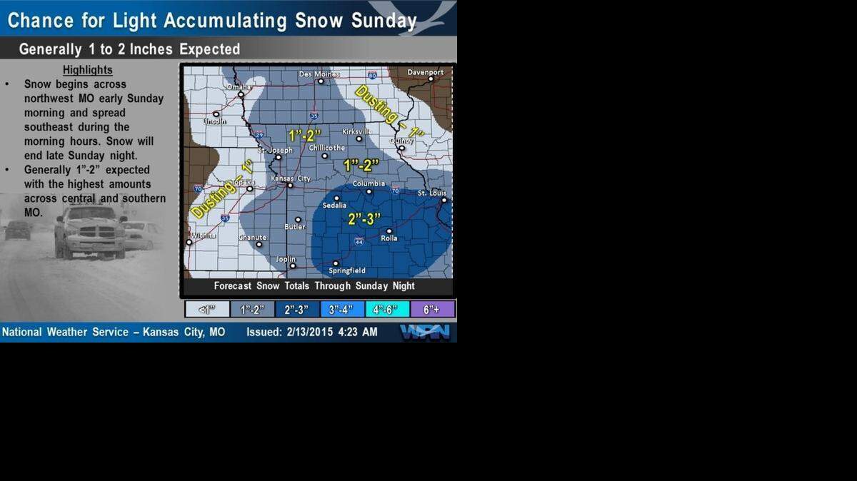
Then snow is expected to start falling early Sunday across northwestern Missouri. The snow will spread southeastward across the metropolitan area Sunday morning and continue through the day.
The Kansas City area is likely to see 1 to 2 inches of snow. Meanwhile, the heaviest snow is expected to fall across central and southern Missouri, with 2 to 3 inches expected in Columbia, Sedalia, Springfield and Rolla, according to the National Weather Service.
Highs Sunday will reach into the low-20s.
Highs for the first part of next week are expected to be at or below freezing.
To reach Robert A. Cronkleton, call 816-234-4261 or send email to bcronkleton@kcstar.com.