KC’s crisp, fall-like temperatures continue to set record
Kansas Citians woke up to another record-breaking morning Wednesday as crisp, fall-like temperatures promised another pleasant day.
Temperatures fell to 55 degrees at Kansas City International Airport Wednesday morning, breaking the previous record low for this date of 57 degrees set in 1985, according to the National Weather Service in Pleasant Hill, Mo.
St. Joseph also tied its record low for this date of 54 degrees, which was set in 1970.
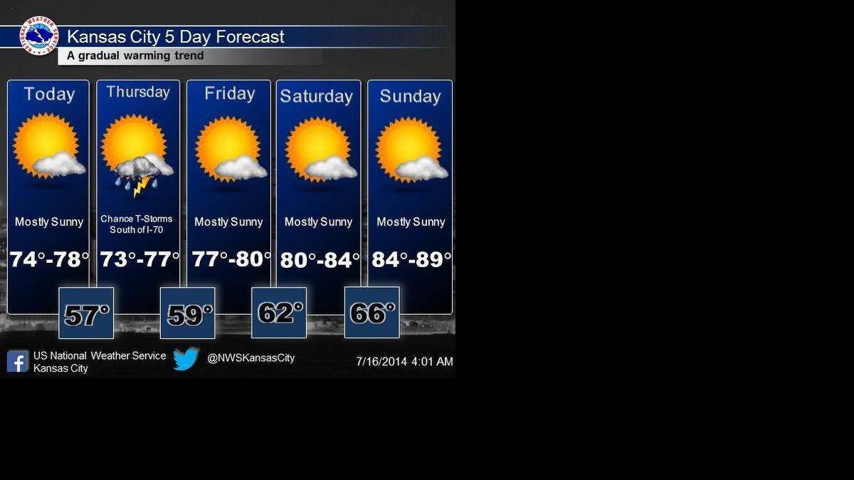
The nice weather is expected to continue through the work week. Highs are expected to be in the middle to upper 70s on Wednesday and Thursday and then upper 70s to 80 on Friday, the National Weather Service said.
Temperatures will gradually warm this weekend, with highs reaching into the lower to middle 80s on Saturday and middle to upper 80s on Sunday.
There’s a chance for thunderstorms on Thursday, but the storms will generally be south of Interstate 70. They are not expected to be severe, according to the National Weather Service.
The crisp temperatures come at a time Kansas City typically sees its hottest days.
Kansas City’s highs peak between July 15 and Aug. 6. The normal high during that nearly three-week period is 89 degrees, based on the average of highs from 1981 to 2010.
Robert A. Cronkleton, bcronkleton@kcstar.com
This story was originally published July 16, 2014 at 8:56 AM.