Severe thunderstorms likely to move across Kansas City region
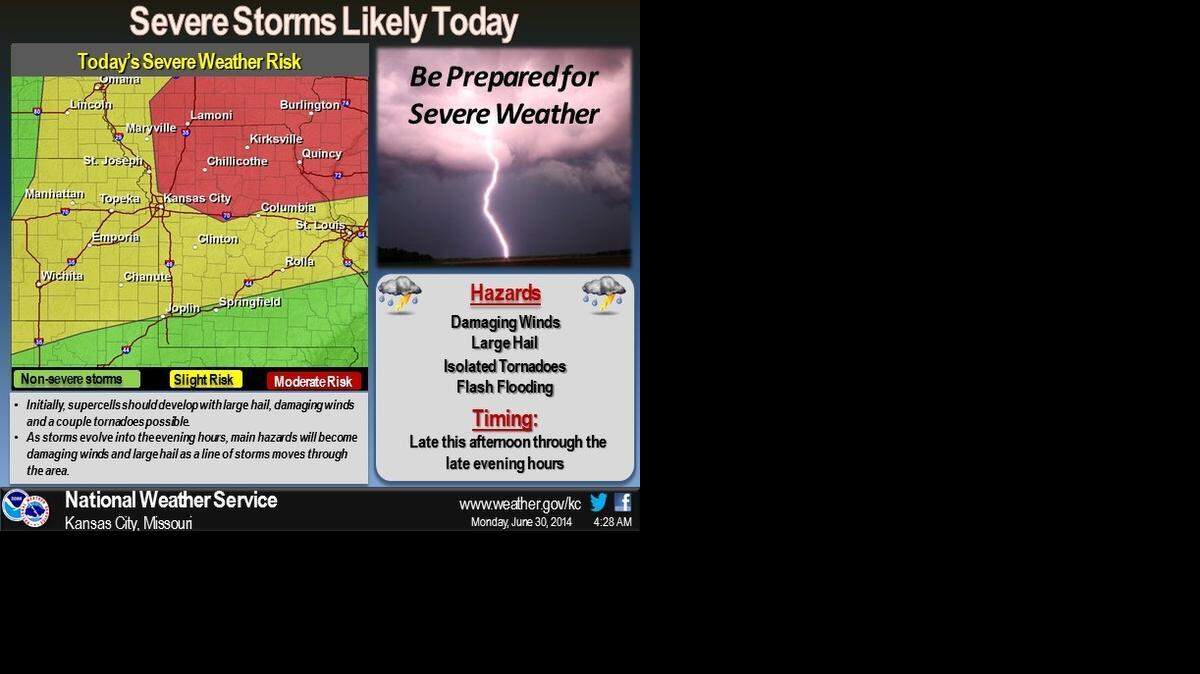
Another round of severe thunderstorms is expected to move across the Kansas City region Monday, bringing the possibility of large hail, damaging winds, flash flooding and a few tornadoes.
The storms are expected to move into the area later Monday afternoon, according to the National Weather Service in Pleasant Hill, Mo.
Northwestern Missouri could see the severe weather starting as early as 5 p.m. For Kansas City, the storms are expected mainly after 8 p.m., the National Weather Service said on its Facebook page.
The thunderstorms are expected to develop this afternoon along a cold front and then build southward through the evening.
Kansas City will see hot and humid temperatures before storms arrive. Highs are expected to be in the lower 90s with the heat index around 100 degrees Monday afternoon.

Robert A. Cronkleton, bcronkleton@kcstar.com