KC’s near record high to give way to cooler temps, chance of rain
A cold front moving through the Kansas City region is expected to end the run on our unseasonably warm fall weather, sending temperatures tumbling back to normal and possibly bringing rain.
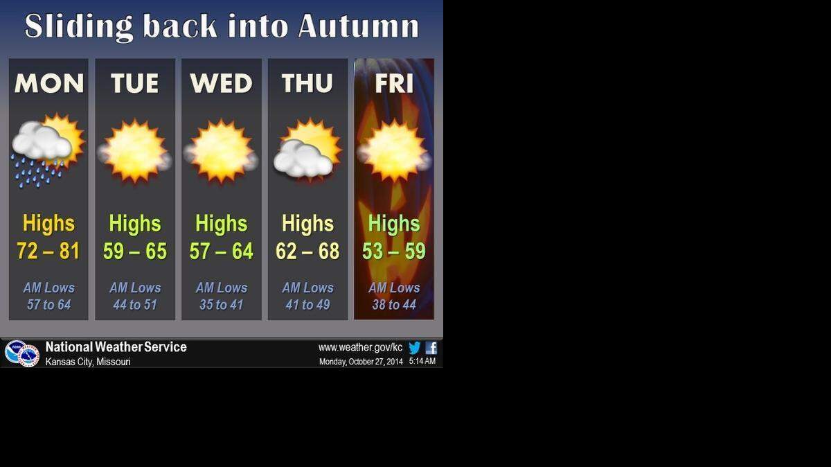
Highs are expected to be nearly 20 degrees cooler later this week with lows falling to near freezing in some areas by the end of the week.
On Sunday, Kansas City reached 85 degrees, just shy of the record high of 87 set in 1963.
Meanwhile, St. Joseph set a record high of 88 degrees.
Monday is expected to remain unseasonably warm, with highs in the middle- to upper-70s.
As the cold front moves through Monday afternoon and night, showers and a few isolated thunderstorms are possible. The best chance for rain will be east of the Kansas City area.
Highs for the rest of the week will be in the 50s and 60s. Lows are expected range in the lower 30s to upper 40s. Northern Missouri could see freezing overnight temperatures by the weekend.
To reach Robert A. Cronkleton, call 816-234-4261 or send email to bcronkleton@kcstar.com.