
Strong, severe storms threaten Kansas City area. Will rain linger all week?
The first day of fall will get off to a turbulent start in the Kansas City area, with strong to severe storms that could bring powerful winds and damaging hail, according to forecasters.
After some patchy morning fog, the sun should make an appearance across the region by late Monday morning, the National Weather Service said.
Temperatures are expected to climb into the low 80s, slightly above the metro’s average of 77 degrees for this time of year.
Showers and thunderstorms are expected to develop in eastern Nebraska and western Iowa, then move into northwestern Missouri by Monday evening.
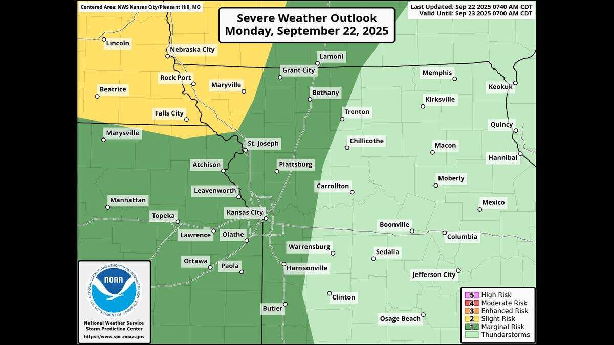
Strong to severe thunderstorms will be possible, with wind gusts of 60 mph and quarter-sized hail possible, mainly west of Interstate 35, the weather service said. The storms are expected to weaken as they move eastward.
Areas north of St. Joseph are at a slight risk for severe weather — the second-lowest of the National Weather Service’s Storm Prediction Center’s five categories — while Kansas City is at a marginal risk, the lowest level.
Additional storms possible overnight in KC
A second round of storms is expected overnight as a cold front pushes into the area. The weather service said these storms are not likely to be as intense, but they could still have gusty winds.
The cold front is expected to move slowly across the Kansas City area on Tuesday morning. Showers and thunderstorms will remain possible through Tuesday and into Wednesday night, as the weather system lingers. No severe weather is expected after Monday night.
Temperatures will be in the low to mid-70s in the metro on Tuesday and Wednesday.

Dry, seasonably warm weekend
Drier weather will then move in on Thursday, although a few showers may be possible mainly in eastern Missouri.
For the extended forecast, Kansas City looks as if it will be seasonably warm and dry from Friday through Sunday, the weather service said.
Temperatures on Friday will be in the mid-70s to near 80, but will rise into the low to mid-80s by Sunday, which is about 10 degrees above normal for late September, the weather service said.
This story was originally published September 22, 2025 at 8:07 AM.
