
Stormy week ahead for Kansas City. Here’s what you need to know about severe weather
The Kansas City area faces a stormy week, beginning with the threat of strong southerly winds on Monday, according to the National Weather Service.
Wind gusts may approach 40 mph Monday afternoon across eastern Kansas and western Missouri for an hour or two, the National Weather Service said.
“Stronger, more widespread strong winds are expected on Tuesday,” the weather service said. “A wind advisory is in effect Tuesday for eastern Kansas into far western Missouri, including the KC metro where wind gusts of 45-50 mph are expected.”
Summer-like temperatures will also continue, with temperatures in the low to mid-80s on both days.
With warm and windy weather combined with dry conditions, there will be an elevated fire danger. The weather service said that neither Monday nor Tuesday would be a good day for outdoor burning.
Severe weather looming
A cold front is expected to push through the region Wednesday, bringing the chance for rain showers and thunderstorms in the afternoon and overnight. The weather service said some of the storms could be strong or severe.
An inch or more of rainfall is possible from the storms, the weather service said.
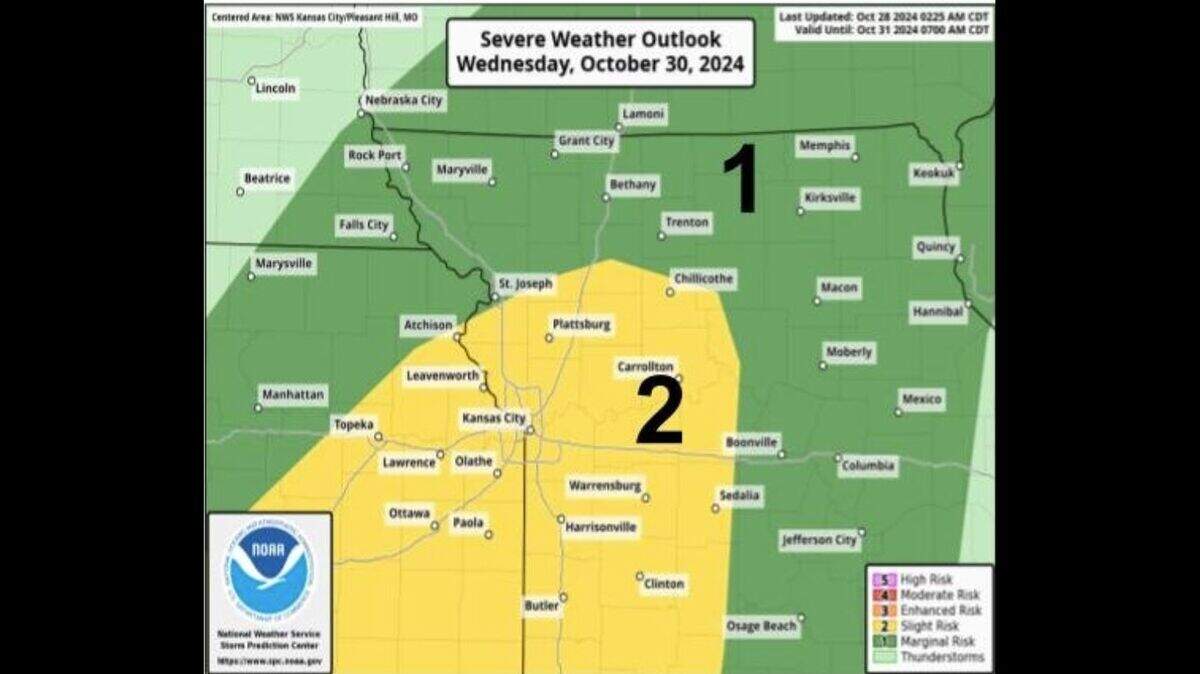
The weather service’s Storm Prediction Center has placed the metro area and the southwestern corner of the Kansas City forecast area at a slight risk of severe weather for Wednesday.
Temperatures are expected to be in the mid-70s on Wednesday.
Cooler weather for the weekend
“Expect cooler temperatures starting Thursday into the weekend,” the weather service said. “Temperatures are expected to be a few degrees above normal which will be a nice relief from the warmer temperatures anticipated earlier in the week.”
Typically, Kansas City sees temperatures in the low 60s this time of year.
The chance for rain returns this weekend as the next storm system moves through Saturday into Sunday.
