
Heavy, beneficial rains are possible as cold front moves into the Kansas City metro area
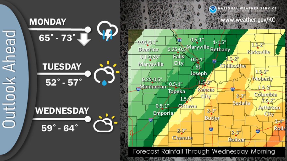
A cold front is expected to sag into the Kansas City area Monday bringing cooler temperatures, showers and thunderstorms capable of producing heavy rainfall, according to the National Weather Service.
The heaviest rain is expected to fall south and east of Interstate 35. While Kansas City could see up to 2 inches of rain by Wednesday morning, areas further south and east like Butler and Sedalia in Missouri could see as much as 3 inches of rain.

Periods of showers and thunderstorms are expected to bring much welcomed rain to the metro area, which is experiencing extreme drought conditions, according to the latest U.S. Drought Monitor maps.
The dry conditions, along with strong winds, allowed a grass fire to quickly grow Sunday in south Kansas City, forcing officials to close Interstate 470 and evacuate some nearby residents.
For the year, Kansas City has had 28.02 inches of precipitation. That’s more than seven inches lower than the 35.16 inches of precipitation that is typical by this time of year in Kansas City, according to data from the NOAA Regional Climate Centers
“This will be beneficial rainfall as it is related to fire weather as well as if not improving the drought then at least keeping it from getting worse,” the weather service said in its forecast discussion.
Temperatures on Monday are expected to fall as the cold front moves through. At midnight, it was 77 degrees at Kansas City International Airport, which is about 13 degrees above the normal high of 64. Temperatures are expected to fall into the mid-50s by 5 p.m. Monday, the weather service said on Twitter.
The cooler, more seasonal temperatures, are expected for the remainder of the week, the weather service said. A chance of showers returns Thursday night.
