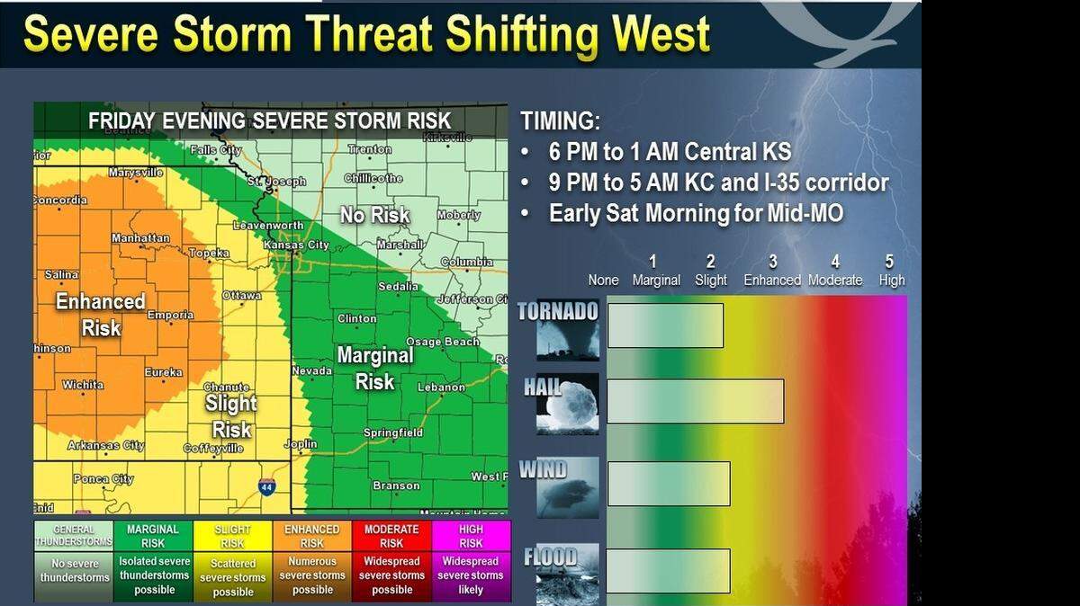
Threat of severe storms shifts west of Kansas City
It appears that Kansas City will be spared the severe weather, but not the heavy rains on Friday.
The threat of severe storms has shifted west of the Kansas City area, and the threat of tornadoes is also decreasing, according to the National Weather Service.
It’s anticipated that the air over the Kansas City area will not be warm enough and the storm system won’t arrive early enough to produce strong storms in the Kansas City area.
However, rain and thunderstorms will pop-up across the Kansas City area into early Friday afternoon.
Another round of storms and thunderstorms is expected this evening through the overnight hours.
Heavy rainfall is possible north of Interstate 70 Friday night, with northern Missouri seeing an inch or more of total rainfall, according to the National Weather Service.
The chance for rain decreases from west to east on Saturday.
Expect dry weather for the rest of the weekend and into early next week. Highs on Sunday will be in the lower 60s.
To reach Robert A. Cronkleton, call 816-234-4261 or send email to bcronkleton@kcstar.com.
This story was originally published April 24, 2015 at 9:42 AM.