Stormy weekend ahead for Kansas City
It looks like it will be a wet weekend for the Kansas City area.
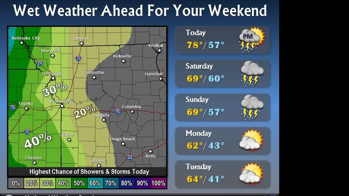
But before the rains, we’ll be treated warm, above-normal temperatures with highs are expected to climb into the mid-70s to near 80 degrees.
The chance for widely scattered showers and storms, however, will increase Friday evening — especially after midnight, according to the National Weather Service.
Showers and thunderstorms are likely Saturday morning with the chance of rain rising above 80 percent before dropping to about 40 percent in the evening hours.
Highs Saturday will be in the upper 60s to near 70 degrees, according to the National Weather Service.
Overnight storms should move out of the area by Sunday morning. But an additional round of storms is possible Sunday afternoon and evening.
Severe weather isn’t expected, but a few stronger storms that could produce hail or damaging winds are possible across central Missouri, according to the National Weather Service.
Highs will be in the upper 60s to near 70 on Sunday.
Rainfall through Sunday morning could total between 1.25 to 1.50 inches in the Kansas City area.
Skies are expected to gradually clear Monday as cooler temperatures move in behind this weekend’s storm system.
Highs are expected to be in the low 60s on Monday and middle 60s on Tuesday.
To reach Robert A. Cronkleton, call 816-234-4261 or send email to bcronkleton@kcstar.com.