Several rounds of thunderstorms headed Kansas City’s way
It appears it will be stormy the next few days in Kansas City.
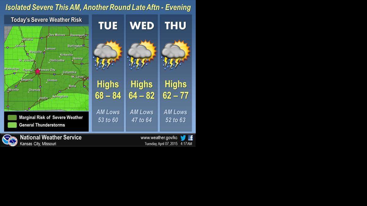
A round of storms, weather that could be strong to marginally severe, is possible Tuesday afternoon and evening, according to the National Weather Service
The storms will follow what is likely to be a warm and muggy day. Highs Tuesday are expected to reach into the mid-80s.
The afternoon and evening storms mainly will be from Kansas City to the southwest. Hail is possible if the storms develop, according to the National Weather Service.

Additional thunderstorms are possible Wednesday into Thursday. The best chance for severe storms will be Wednesday evening and overnight and then again Thursday afternoon.
There’s potential for supercell storms with large hail, damaging winds and possible tornadoes Wednesday, according to the National Weather Service.
There is uncertainty to the timing and location of the greatest risk.
Additional severe storms are possible Thursday afternoon, however central and eastern Missouri are the most likely to experience severe weather, according to the National Weather Service.

This story was originally published April 7, 2015 at 8:36 AM with the headline "Several rounds of thunderstorms headed Kansas City’s way."