After stormy night, first severe weather of year possible for Kansas City
After a stormy night, Kansas City could see its first severe storms of the year on Tuesday.
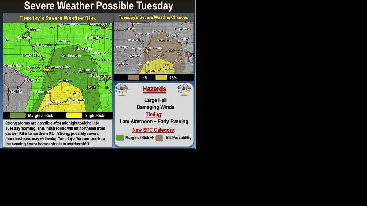
Two rounds of thunderstorms are expected to move through the Kansas City region Monday night and Tuesday, according to the National Weather Service.
The first round of thunderstorms is expected to form over Kansas Monday evening and then track northeast into west-central and northwest Missouri around midnight.
The heaviest rains are likely to fall north of Interstate 70. And while the storms are likely to be strong, producing some hail and heavy rain, the likelihood of them being severe is low, according to the National Weather Service.
The overnight storms will exit northern Missouri by mid-morning Tuesday, making way for the second round.
That second round of storms has the potential to be stronger and is expected to form Tuesday afternoon. The storms are expected to create a squall line and track east through central Missouri, according to the National Weather Service.
A few of the thunderstorms could prove severe, with large hail, lightning and damaging winds. While tornadoes can’t be ruled out, the risk will be “quite low,” the National Weather Service said on its Facebook page.
Areas east of Interstate 35 will have the greatest chance for strong to severe thunderstorms.


To reach Robert A. Cronkleton, call 816-234-4261 or send email to bcronkleton@kcstar.com.
This story was originally published March 23, 2015 at 8:53 AM.