Storms with heavy downpours, frequent lightning hamper KC’s morning commute
It’s going to be a wet commute for Kansas City area drivers Wednesday morning.
Thunderstorms developed over eastern Kansas and western Missouri and slowly moved into the greater Kansas City area around 6 a.m.
Although the showers and thunderstorms were not expected to be severe, the National Weather Service said heavy downpours and frequent lightning were possible. Small hail also was possible.
The storms prompted the National Weather Service to issue a flash flood warning for Linn County, Miami County and western Johnson County in Kansas until 11 a.m.
The slow-moving thunderstorm was accompanied with very heavy downpours. Radar estimates suggested that as much as 4 inches of rain had fallen across the area in the warning and additional heavy rain was likely.
A flash flood warning also has been issued for Douglas County, northern Shawnee County, southeastern Jackson County and southern Jefferson County in Kansas until 9:45 a.m.
Radar indicated that very heavy rain of 2 to 4 inches had fallen during a two-hour period over those counties. An additional 1 to 2 inches was possible.

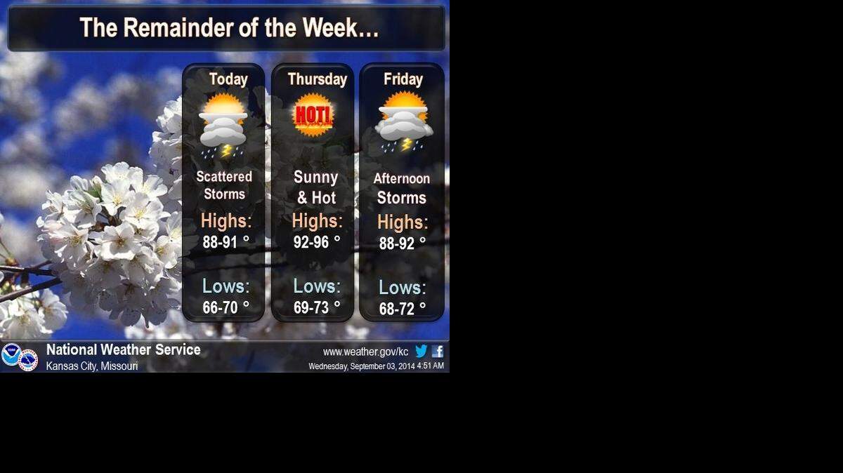
After the storms move through, Kansas Citians can expect much warmer air to move in.
Highs Wednesday are expected to be in the upper 80s to lower 90s, while Thursday will be hot with highs in the lower to middle 90s.
The heat index is expected reach as high as 102 degrees by Thursday afternoon.
A strong, slow-moving cold front is expected to approach the area, bringing the chance for showers and thunderstorms Thursday night through Friday and into early Saturday. The threat of severe weather remains low.
Robert A. Cronkleton, bcronkleton@kcstar.com