Kansas City’s gradual warmup means highs in the 60s next week
The forecast for the next week will be good news for those who are tired of winter and want a taste of spring.
There will be a gradual warmup the next seven days with temperatures reaching into the 60s by next week.
The snow Wednesday also was the last precipitation in the forecast for the next seven days, said Jared Leighton, a meteorologist with the National Weather Service in Pleasant Hill, Mo.
The Kansas City area only received a dusting to half inch of snow Wednesday in some areas.
It will be cold before it gets warmer. Wednesday night’s low is expected to be around 10 degrees, and Thursday’s high is likely to be in the 20s to maybe 30 degrees.
“Friday we will see some semblance of spring — temps will be in the low 50s,” Leighton said. “By the weekend, we will start to get some traction with temps in the 50s and maybe 60s by next week.”
Basically every day will be a little warmer than the previous one — all the way up into the middle part of next week, Leighton said.
But don’t pack up your winter gear and snow boots yet.
It’s too early to declare winter over, even if the momentum of the next seven days indicates that spring is on the way and there are no hints of a snow-making system on the horizon, he said.
“We know that late March can bring some doozies,” Leighton said.
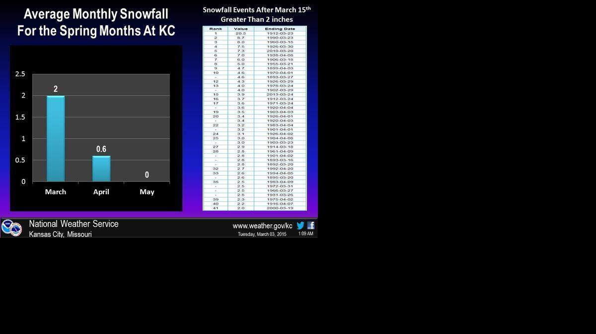
The National Weather Service posted a graphic to its Facebook page showing that the average snowfall for March in Kansas City is 2 inches, while April is 6/10th of an inch and zero inches in May.
“If we make it to March 20 and there is no snow on the horizon, then we probably can start to gear up for spring and put this winter behind us,” Leighton said.
To reach Robert A. Cronkleton, call 816-234-4261 or send email to bcronkleton@kcstar.com.
This story was originally published March 4, 2015 at 2:49 PM with the headline "Kansas City’s gradual warmup means highs in the 60s next week."