Cold starts week; snow possible Wednesday, weekend
The work week got off to a bitterly cold start in Kansas City early Monday as temperatures tumbled into the single digits.
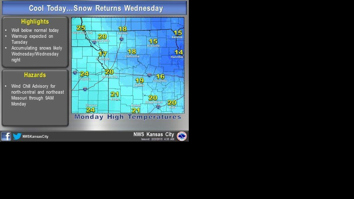
Wind chill values of 10 to 15 degrees below zero were common across north-central and northeastern Missouri in the morning, according to the National Weather Service in Pleasant Hill.
The temperature was 7 degrees at 6 a.m. at Kansas City International Airport.
Highs on Monday were expected to climb into the upper teens to lower 20s.
There will be a slight warmup Tuesday with highs returning closer to normal. Highs of upper 30s to low 40s are possible, according to the National Weather Service.
Weather conditions are expected to deteriorate Wednesday afternoon, as a storm system moves into the area along with accumulating snow. The evening rush hour might be affected by the storm, according to the National Weather Service.
The snow is expected to end by Thursday morning, with widespread accumulations of 1 to 2 inches possible. Some areas may see a few inches.
Northern Missouri is expected to see the heavier amounts, decreasing the further south you go.
Another potentially stronger storm appears to be moving toward Kansas City this weekend.
Though the National Weather Service said it’s difficult to pin down details, a prolonged period of wintry weather is possible both Saturday and Sunday.
To reach Robert A. Cronkleton, call 816-234-4261 or send email to bcronkleton@kcstar.com.
This story was originally published February 23, 2015 at 11:58 AM.